Ladakh Odyssey – A Tapestry of Events
Five years ago, on this day, we started this epic journey, the memories of which are still very fresh in our minds. This journey was a litmus test of our young relationship and we passed it with flying colours. A lot has happened in the past 5 years – we took many road-trips – drove to Bhutan, did several non-stop 24+hours drives. Crazy as we are, we even drove over the weekend to Mumbai and back. We made some wonderful friends and lost touch with a few. All that said, our Laddakh odyssey was a significant milestone of our lives. We still remember, vividly, the details of our experience at Baralacha Pass and our night at a homestay in Upsi or camping in Panamik.
The important thing is that we have been able to sustain the spark – both in our relationship and our passion for driving and travelling.We wish to travel the world, together and drive wherever we can and we hope we will
Neha & Puneit
Togetherness - a journey through time
Prologue

An unforgettable road trip with my sweetheart,spanning more than 3500 km in 9days, witnessing tough terrains, snow clad mountains, traversed world’s top 3 highest motorable mountain passes [1st Khardung La, 2nd Tanglang La & 3rd Chang La], did rafting in Sonamarg, Camel Safari in Hunder – Nubra, visited war-memorials in Kargil & Drass, witnessed snow fall at Khardung La, hailstorm in Bilaspur & camped at Panamik, Nubra. Rescued people and got rescued. To sum it up, it was an ultimate road trip with one of the best roads in India (NH 1) to one of the worst & unimaginable terrains – we drove it all – right from mud, snow, ice, rocks, drains, rivers & torrents, broken bridges, dust storm, hail storm, heavy rainfall, broken roads, no roads, off-roads without any damage to the car. We are glad to have completed the Delhi -Srinagar-Leh- Manali-Delhi circuit when everyone said it was not possible to cover…
View original post 9,678 more words
Kasol & Tosh: Untouched beauty of Himachal Pradesh

Double rainbow at a waterfall in Tosh, Himachal Pradesh
Most people when first hear of Kasol, confuse it with Kasoli. This is because, Kasol is an offbeat Himalayan town situated very close to the Sikh shrine of Manikaran. Manikaran is famous for two reasons or the combination of the two reasons – one, it hosts a famous Sikh temple (gurudwara) and two, it has hot water springs. Kasol has some feathers to its hat as well. It is famous amongst the Israelis and Italian tourists and it is famous for hash and marijuana.

Driving to Kasol
Neha and I had traveled to Rishikesh with our new couple friends – Sonal and Amitoz the week earlier and since then, we all were pretty worked up about another trip. Initially, Neha and I had planned for Kanha Tiger Reserve but that was sold out completely; thus, our plan shifted from tiger spotting to cooling ourselves off in the hills. Sonal was quite keen on going to Kasol and its surrounding areas as she had been hearing travel stories from her office colleagues and wanted to explore and experience this part of the country. The dates decided for the trip were 12-16 June 2014. As we inched closer to the departure dates, each one of us started researching on the different aspects of the trip. Amitoz bought camping gear after I ranted and yapped about how cool and exciting experience camping is.

Reaching Kasol
This opened an option of camping- either at Kasol or Tosh. While Neha and Sonal looked up hotels and their reviews, I checked out the route plan, road condition and overall review of these places from HV Kumar. At the same time, I wrote to Dheeraj Sharma of Devil on Wheels for his inputs. Gurgaon to Kasol: Thursday 12 June 2014 1 am to 3.30 pm Thanks to the inputs from HVK Facebook forum, we were aware that the road up to Bilaspur, Himachal Pradesh has heavy traffic and one must start early to munch as many miles as possible. Thus, we started at 1 am from Gurgaon and by 1.15 am we had picked up Sonal & Amitoz from their home and we embarked on our journey. We found traffic right from NH8 and this forced us to take the internal roads of Delhi to reach the Burari turn to NH1. We stopped over at Gulshan Dhabba for food and bought some folk Punjabi music CDs from one the shops near by. Our next stopover was for fuel near Ambala and then we

Crossing bridge across the river..
took the Shambhu – Roopnagar road towards Bilaspur. Our plan was to cross Bilaspur before 7 am but we entered Swarghat by only 7. We were running behind schedule but it was not that a big deal. Neha and I were alternating the driving after every hour or so and our next halt was after Bilaspur for food. By this time, Dheeraj Sharma responded to my query and connected me to Doulos Jose (who happens to work in the same building that I do- small world). Doulos had been to Kasol a week before and he gave us valuable tips about the place. Through Doulos we got in touch with Om Negi who runs a camping site just outside Kasol. So, while we ordered Maggi and some paranthas, I called up Om Negi and told him about our arrival plans and fixed up a meeting. The journey from Bilaspur to Bhunter was smoother than earlier and much faster. We reached Bhunter around half past one and bought some beers and breezers. At Kasol we met up one of the camp organizers Hemu Negi (cousin of Om) who helped us finding a secure parking spot and started the 25 minutes walk to the camp.

Our first halt for the night at Kasol
To reach the camp, we had to walk across a narrow suspension bridge over the raging Parvati river. What followed then, was a beautiful nature trail. We did get a bit impatient and kept bothering Hemu with the repeated questions “are we there yet”? The camping site was towards the right of the nature trail and we came across a cemented house overlooking a vast stretch of leveled land with several tents pitched on it.

Camping next to Parvati river
We scouted for a place closest to the river and pitched our tents. While we were close to the river, we were at a safe distance and at an elevation of about 5 feet. We settled and ordered some pakodas and then climbed down the rocks and tried the water. It was at 10C and we could not bring ourselves to taking a dip in the river. The water was perfect for chilling the drinks that we brought along. We took some photographs and spent nearly an hour at the rocks. We returned to our camp and played a game of cards and also couple of games of badminton and then as the night approached, fatigue started to creep in.

Moments next to the river
We were awake since the day before, slogged off our asses as corporate slaves and then embarked on this road trip practically without rest.
Dinner came in- chicken gravy, chapatis and vegetarian food for Sonal. Along with the food, came some unwanted guests- dogs. There were several of them around. I would presume these stayed on the property to guard against the wild animals on the prowl in the neighboring forests. The chicken didn’t taste like chicken and the it had been cut into way too small pieces. We didn’t fancy it as much but then when you go camping, this was like elixir from gods and refusing it would have been crazy. As the food settled down, my eyes began to feel heavy and I had to call it a day. I crawled into my tent and zipped up my sleeping bag. Neha too joined me soon and then I heard Amitoz and Sonal saying good night as I was going into a deep slumber.
Day 2

Breakfast at German Bakery

All packed next morning
I had slept in the same position for hours and many bones of body nearly crushed under my own weight. At the break of dawn , I unzipped the tent window to see the surroundings outside. It was a beautiful day, a day I had not seen in many months. Soon, we all woke up and we ordered for some tea from the camp organizers. We also decided to go up till Tosh today and probably spent the night there. Here again, Om Negi helped us with some hotels in Tosh and gave us the bad news. Tosh had no places to camp. Doulos had too shared the same piece of information. The toilets at the camp were quite decent and we comfortably freshened up, packed our belongings, paid Om Negi. He charged us only for the food and not for the space. At some places, where Neha and

Fun moments while heading to Tosh!
I had camped earlier, people took a nominal space rentals to pitch our tents and we were quite surprised that he allowed us to stay for free. We bid good bye and as nomads started walking back to Kasol. We had breakfast at Moon dance cafe aka German bakery. The food was great and so was the music. We decided to visit the place again for food on our way back home. The car was found in the same condition as we left and it was a relief. We had parked our car at the parking space of Kasol Camps.

Israeli Breakfast at German Bakery
We did inquire from their tariffs and they are as of June 2014 1. Rs 500 to pitch your own tent 2. If you want to use their tents then the tariff ranges from Rs 1500 to Rs 3500. Food and beverages extra. From Kasol, now we headed towards Tosh which is about a 90 minute drive from Kasol. The first town and one of major attractions is the town of Manikarn about 5 km ahead of Kasol. At Manikarn, a road forks up on the right hand side and this is the road that goes up to Bansheri. The road ahead was mostly rough, with loose gravel, water puddles and potholes. Though it is very much doable (easily) in a 2wheel drive, we engaged 4 H just to gain speed and stability at certain points. We stopped for a photography session and then headed to the town of Bansheri.

Clicks on our way to tosh!
Here, we could see the construction of a dam and it seemed as if this place is waiting to be commercialised. From Bhansheri, Tosh is about 3 km steep ascent with extremely rough roads. Doulos had warned me of this and had advised to take a taxi in case it was raining. He did not know back then, that we were in a 4wd Scorpio. We did most of the ascent in two wheel drive but then we halted at a steep angle for photographs. Momentum was lost and now we needed traction to continue our journey. 4H was useless, and no way, I wanted to exert stress on the clutch. So, this time 4 L was engaged to climb.

Amitoz & Sonal enjoying the waterfall
The car just glided over the rough terrain. Should the readers of this post wish to take their vehicle up till Tosh, my recommendation is, keep the momentum stable and any vehicle can do this ascent. At Tosh, we had to park our vehicle just outside the village because there is no motorable road inside. A weak and narrow pedestrian bridge is the only entrance to the village. We called up Mr. Tari (Om Negi’s contact)

A very beautiful waterfall in Tosh!
owner of the Pink Floyd hotel and asked him to get directions to his hotel. He asked us to walk into the village and ask anyone for directions. We decided to first check out the place and then assess what all would be required for a night’s stay and then bring in our luggage. The lanes of the village became quite narrow at certain stretches. The hotel is good 15 minutes walk from the parking spot. On the way to Pink Floyd we checked out another place which was just in the beginning of the village and the tariffs were around INR 200 a night, no attached bathrooms. The only advantage was that from its balcony we were able to see our car in the distance. We reached Pink Floyd, drained out of energies but did not really fancy the place. It was good, no doubt but we found the views from Hotel Sunset better. So we took two rooms at Hotel Sunset at INR 300 each. There was hot water, attached bathrooms and electricity for charging our camera batteries. There is a small tuck shop in the premises and a kitchen which can serve Italian, Israeli and Indian food. Wow! I am being greedy here, nevertheless, it is worth a mention- the downside are the bed sheets. They have dark colored bed sheets and pillow covers which means that they are not washed for quite sometime. It is advised to carry your own bedsheet and pillow covers. We ordered lunch and then Amitoz and I left the girls at the hotel and went to fetch our belongings for the night.

Morning tea with Parle-G
We were back in about 40 minutes and the girls were nowhere to be seen from a distance. While we had gone lugging bags, Neha and Sonal had gone on a short trek. They came back just in time of our arrival. From the hotel, we could see in the distance two waterfalls and two bridges. One of these waterfalls was a man-made cemented slide, yet the sheer force of the water was so magnificent that one could perceive it from the hotel. We enquired about the KheerGanga trek for next day but dropped the idea as we were short on time. While the locals said that one can do the round trip in a day, we urban corporate slaves were not the lot to walk so much in one day. We definitely needed two days. The village was quite deserted and from the hotel operators we learnt that most of the tourist have gone to the village of Pulga for a two day “rave” party. This part of the Himalayas is famous for rave parties. Weed is commonly called olive as it is sold in small black balls which resemble black olives. The hotel also told us about another waterfall which was 15 minutes away and we decided to check it out as there was still couple of hours of daylight available. We misunderstood the directions and started

Sitting on hotel terrace!

Natural rock slide…!
walking on a different path. The 15 minutes trek took us nowhere closer to water. A few locals, we spotted on the way told us

Chicken at special request
that we had come the wrong way. We returned and found the correct trail. While walking, photographing, we met some fellow tourists and made another mistake of asking them for directions. These blokes were dressed in clothes one would wear to an office on a Friday. Totally out of place. They misguided us and put us on a different trail. Two of our group members tripped after different locations and it was kind of disheartening. Fortunately, no one got hurt. Around quarter to seven, we gave up the idea of the waterfall and headed back and decided to conquer it next day. An interesting thing happened here, we saw a man with a child playing on a natural rock slide. The crazy ones Amitoz and Neha were the first ones to burn their butts and Sonal and I needed some persuasion. As the last light approached, it was time to reach the hotel. We
ordered chicken and snacks and also got hold of olives ;). It was a full moon night and we stayed on the terrace munching, drinking, smoking and laughing till the temperature dropped to a moderate chill of 13 C. At this time (around 10 pm) the tuck shop and the kitchen also shut down and we retired to our rooms.

Beautiful walk midst greenery

Complete surrender…

Amitoz & Sonal

Euphoria beyond containment…
Day 3
I was the first one to get up and get ready. Woke up rest of the party with some tea and Parle-G. Once everyone was ready, we headed towards the first waterfall which everyone at Tosh was talking about. The hotel staff advised us against the waterfalls visible from the hotel. They said that the water is so fierce and rogue that one wrong move and you will end up in a watery grave. Who listens to such things- not us! Anyway, this time we reached the 15 minutes away waterfall in about 15 minutes. Spent about an hour there and now headed for the falls which mesmerized us since our arrival in Tosh. Here is the route which we followed in June 2014. On the way to the “famous” waterfall there is a rock on which someone had painted waterfall 100 m ahead. At this rock a small water stream trickles down and it also seems to be a dumping ground. A narrow and rough trail goes along with water stream. Now keep following the only trail and keep descending for about 30 minutes. The entire route is quite beautiful except for a 20m garbage dump in the beginning. I have seen Doodhsagar from up close and trust me when I say this, this particular one is comparable to Doodhsagar and is just one day drive from Delhi. We reached back hotel around half past one and told them that we would be checking out. At 3 pm we were in our car and headed to the German bakery at Kasol for lunch. Kasol was crowded. We tried hard for a parking space but could not find it. We tried parking at the taxi parking area but the locals became too aggressive and thus we left. We stopped at The Himalayan Retreat at Jari and enjoyed some really good food. Tried the local dishes – Dham, Kachori and Siddu Momo. Here on, we drove nearly non-stop till Gurgaon stopping twice on the way, once for tea and another time for graveyard shift food at NH1. It took us nearly 9 hours to reach Kiratpur Sahib and another 6 hours to reach Gurgaon. Around 6.30 am, on Sunday we reached Gurgaon. It was a trip successfully completed and the experience was too good. Special thanks to Sonal for picking up the destination, Dheeraj Sharma for connecting to Doulos and to Doulos Jose for helping us connect to Om Negi. Now it was time to sort out the 1800 photographs clicked by us during the three days. By the way, we all tried our hands on our new photography gear. Sonal and Amitoz brought their new Nikon D3100, Neha and I got our new Nikon D5300 and a Nikon AW120. IPhone 5s also proved to be an amazing photography device with its fast f/2 lens. The trip not only helped us rejuvenate but also strengthened the bond amongst the “Chaar Log” (four people -term coined by the Bhandari brothers during our Rishikesh camping and rafting trip) Watch this space for more adventure and travel stories. Ciao!
“We Live Young….We Live Free….We are the Living”!

Neha and I were itching for a trip for weeks now. The most recent was to Spain a month ago and it was beyond time to break away from the shackles of the corporate life.

Introducing – Amitoz & Sonal
We met Sonal and Amitoz (he and I share a desk at office) at a stand up comedy night in Nirvana County club and then at Epicenter for another comedy night. During dinner at Drift, we decided to go for rafting at Rishikesh the following weekend.
On 29 May, Neha got in touch with one of the organisers Vikrant Biswal through Facebook for camping and rafting in Rishikesh. Next day, I talked to Vikrant and understood what all was included in the package and confirmed booking for ‘chaar log’. By evening, before leaving for home Amitoz and I confirmed our plan for next morning. I woke up at 3 am and called up Amitoz to wake him up. He did not answer his phone. After 3 calls, I called up Sonal and the couple woke up. We met them at their home around 4.30 am.

24 kms straight to go..
We started our journey towards Rishikesh and took the Mohan, Meerut, Upper Ganga canal till Roorkee cantonment, Rajaji National Park through Cheela Dam and then through the Dugadda range, Laxman Jhoola to the camp site. The camp was located some 3 km ahead of Shivpuri next to the Rivera Resort.

Backpacker-up in the woods….
The camp was being managed and operated by the Bhandari brothers -Roop Singh Bhandari and Teg Singh Bhandari. We met RP outside the resort and he identifed us as the chaar log, the group of four people. He got our car parked and asked us to take our belongings with us. The camp was situated some 300 meters down into the valley and the temperature was around 40 C when we started trekking downhill. By the time we reached and dumped our luggage into our assigned tent, lunch was served. Teg Singh warned us about swimming in the river and pointed some safe zones to stay in. As soon as we entered the water, we wanted more and more of it. Our skins cooled from scorching 40 C to a cool of 20 C. We had ordered

Enjoying chilled beer at the ganges!
some beers which were put in a sack and tied to rock and dipped into the river to cool. We sipped on the beers while we enjoyed being soaked into the refreshingly cool water. As the sun hid behind the mountain in the west , we headed for the beach volleyball court and started a couples game. A few serves were thrown and none of the team could play the game well. We dropped the idea of volleyball and played several games of badminton. We played couples vs couples, swapped teams (arrest your kinky thoughts, please) and boys vs girls.

Beach Volleyball-Game begins

Middle of action
Between the matches we took breaks and cooled ourselves in the river.
After the evening snacks were served, we pulled out the beds from the alpine tents and started chatting over some more beers. As the night deepened, millions of stars shone into the black canvas over our heads. Neha spotted a couple of stray but bright meteors while we talked on topics of our respective love stories , relationships etc. The

Sonal in action..

Neha full on..
dinner was getting delayed and I called it day and retired for the night.
Next morning, I woke up at the break of dawn. I could still see few stars as I lay awake in the bed overlooking the Ganges under the open sky. The next one to wake up was Sonal and the two of us fetched tea for our respective sleeping beauties. As the three of them sipped tea, we got ourselves booked into the pre-breakfast rafting groups. By 7 am, the sky darkened again, this time we rain and thunder. As it began to pour, we carried our bags up the trail to our car. For the chaar log, this was the first trek of the lifetime in the rain.

Snacks time: Pakoda & Chai!
For me, it was quite an exciting trek. All the while, the jingle from Mahindra’s advertisement was playing in my head which goes like this, “We live young, we live free, we are the living”. By the time we reached our Mahindra Scorpio, we were completely drenched in the rain.
We had to wait a while before the rafting transportation vehicle came. The vehicle took us to the point which is called the Marine Drive. We made it a point to take a first pick at the rafting gear. We went for the best available hemelts, buoyancy aids and oars. We also profiled the other rafters and picked the ones who seemed okay to us. The initiation ceremony was – yes you

Men will be boys!!
guessed right -the safety brief. Amitoz and I were positioned in the front of the raft, Neha behind me and Sonal behind her soulmate. We roared the raft through rapids, jumped into the water and had great fun. The water temperature read 19 C on my Casio Gshock.
We took a break for breakfast at our camp and then resumed the craziness. This time, Neha and I exchanged our position on the raft. At one of the rapids, our guide cum captain, permitted us to jump into the water. We were to hold the

Identified as ‘Char Log’ throughout!
perimeter ropes so as to remain attached to the raft. I jumped and then Neha jumped. I looked up and saw Amitoz and Sonal still sitting. He got late by a jiffy in jumping and now it wasn’t safe to leave jump into the ragging but shallow waters. My eyes searched for Neha and she wasn’t visible. I guided myself to the front of the raft and saw her holding a tethered rope instead of the perimeter rope. The freely swaying rope was not giving her stability in the rapid. While jumping, she had picked the wrong rope. It took me 10 seconds to reach her and pull her towards me.
Once we reached calm waters, We climbed up. And then, Amitoz jumped into the
water and invited me to join him.

Well what to say, my sweetheart & I! 🙂
We made a human chain so as to distance ourselves from the raft and yet be within rescuable distance from the raft. Now, we were on the last leg of our rafting trip. As we approached the shore, we all were attracted by the high velocity sound of the zipline above our heads. While we contemplated to go for zipping, we reached tge pickup point frpm where the transport vehicle was supposed to drop us back to the camp site. We waited for about 10 minutes and started to feel u easy in wet clothes. We took a lift from a dumper truck back to our car which was 3km away.
We changed into dry clothes, paid the guys and started journey back home. We started around noon and got stuck into several traffic snarls. It took us nearly 11hours to cover 300 km with two breaks for food and one break for kulfi ( an Indian frozen dairy dessert) . It seemed that the entire population of Delhi was in Rishikesh that weekend as there was very thin onward traffic towards Rishikesh.
Camping along the banks of the Ganges and rafting are surely refreshing activities and can be done more often if the traffic situation improves.
Transit of Venus 2012

Venus in transit
Universe has a plethora of amazing views and sites to display to us astronomers.
The scale of our solar system is negligible to the vastness of the universe. Still, some of best views of the universe are right there in our backyard. Saturn and Jupiter are one of the best viewed objects in our solar system. Venus too shows beautiful phases just like our Moon. We just need to know where and when to look.
Celestial bodies strictly follow mathematical equations which were laid down by Kepler, Newton and many others. This makes it easy for us to determine the exact position and timings of rare events such as the transit of Venus. Earth’s orbit around the sun places us third to Mercury and Venus. This allows the earthlings to view not only the phases of these two planets but also, though rarely, the motion of these planets across the disk of the sun relative to earth. These are termed as transits.

Sun playing hide and seek amidst clouds
The transit of Venus follows a rather complex pattern; they occur in pairs separated by 8 years and these pairs occur every 105.5 years or 121 years. The next transit of Venus will occur in December of 2117. This makes it one of the rarest events for the living population of the planet. (Unless someone somewhere discovers the fountain of youth and makes it accessible only to astronomers or a breakthrough in cryogenics takes place and people can extend their lives at will)
Like many teams which were formed to witness this rare celestial event, we too formed a team and we called it Astrohams – which signifies the two hobbies which are astronomy and ham radio (also known as amateur radio). The team comprised of the following individuals

Core Team with their paraphernalia
1. Puneit Thukral
2. Neha Thukral
3. Kaustav Saha
4. Tarveen Bhasin Saha
5. Eshaan Saha
We not only called ourselves Astrohams but also, combined both the hobbies during the transit of Venus.
Objectives
The primary objective was to view the transit safely. The secondary objectives were to photograph, web-stream and SSTV streaming of the event so that the not so lucky ones can also witness this rare, once in a lifetime event
Selecting the Venue
Once an experienced amateur astronomer told me, that for a rare astronomical event, concentrate on location location and location. Rest everything will fall into place. And this is what we did. The transit occurred on June 06 2012 and it was visible at sunrise across India and most parts of the world. This gave us a huge geographical area to choose our location. Now, we had to look for a location where the probability of clouds during sunrise was low and of course has a clear view of the horizon so that the event can be witnessed as early as possible.
We didn’t have to look too far, the terrace of our house turned out to be good location. It had several advantages
1. We had high speed Internet access which would allow streaming the event live on the Internet
2. Our ham radio setup could be relocated easily on the terrace which would lower the setup time
3. There was no need for travel thereby saving travelling cost and time.
Thus we finalised our terrace as the location for transit of Venus. Having done that we registered our event with NASA as well.
Preparation
Weeks before the transit, we began arranging for the most crucial element to a safe observation – a solar filter. Our friend, Sneh, helped us with a sheet of a solar filter with which we created filters for our cameras, binoculars and newly acquired 10″ Skywatcher telescope. We were going to use 4 cameras & 1 webcam for the transit. Also, we ran some rehearsals to understand the position of sun at sunrise at the horizon and calculated when the transit will be actually visible to us in case of clear skies. We made a list of things needed and also tested out Ustream broadcasting as well as SSTV transmission on Ham bands. Many of the Delhi Hams participated in this rehearsal and helped us fine tune our setup.
Transit
We had planned for months that we will be staying home a day before the transit in case we have to travel in the event of a bad weather. As with any major astronomical event, I was studying satellite images for days now and understanding the movement of cloud cover. During the month of May and early June Northern India receives pre-monsoon showers which are accompanied by dust and thunder storms. This is due to the low pressure area created by the heating landmass which sucks in dust and moisture laden winds from surroundings. And it is now an established fact the cities being warmer than countryside are more prone to dust and thunder storms. It had been raining a few evenings before the transit which made the morning sky clear. However, during the first week of June, a big patch of cloud covered major cities in India. Upon studying visible, infra-red and water vapour channels images sent out by Kalpana-1 satellite, I decided to stay put in Gurgaon, even though the evening looked as if the cloud cover will not dissipate. I had seen a break in the cloud cover and the motion over time suggested that we will have broken clouds to clear skies by morning.
The morning of 6 June arrived and we were ready with our setup by the break of dawn. We did some final test runs and then waited for the sky to clear up. The south and west were clear and the north and east were covered with broken clouds. However, a nice and cool breeze gave us the confidence that the clouds will be soon dispersed and we shall soon be able to witness the transit.
The glowing disk of our nearest star was first visible at around 6.30 am local time and it was the most beautiful sight of the day. The broken clouds acted as a natural filter making it safe for us to view the sun directly. At this stage our solar filters were too dark for the faint disk of the sun. Amidst the clouds, we could clearly see a tiny black spot on the face of the sun. It is the best picture of the Transit that we took that day.
As our planet turned on its axis, the Sun gradually gained altitude in the sky, increase its luminance every second. The sky cleared up too and soon we were looking at the Sun through protective solar filters. Having witnessed the Total Solar Eclipse of 2009 which just lasted over 3 minutes, 5 hours of Venus transit was like a lifetime. There was so much one could do in 5 hours.
Kaustav and Neha attempted to transmit live image of the telescope through the webcast of the event – Kaustav’s office colleagues guiding him over phone (they were watching us from their office) on how to achieve a good focus with the webcam. This of course was not very stable as it was not planned earlier and thus they were trying it for the first time. Many first time observers stumbled upon to us and we formed a ritual that was to be followed – at first the were supposed to look through protective filter without any magnification and then with binoculars and finally with the telescope. No one was allowed to jump this and go directly at the scope. We shared with them the significance of the transit and how the first organised transit of Venus helped mankind to understand the scale of the solar system.
Parallely, we were uploading photographs on social networks such as Facebook and Twitter as well as transmitting near live images of  the transit through amateur radio equipment using the SSTV mode on 2m & 20 m bands. Even though we did not get a response on 20 m; there was appreciable activity on 2 m. Days later, I saw one of the received images on Facebook which we had transmitted. The view from the telescope was mesmerising. The black drop of Venus among the sunspots looked so pretty that there are no words that can describe.
Back in Hanle, the sky was overcast and there was no hope to see the sun. Soon our friends who were sitting at IIA looking at Hanle, saw our webcast and decided to embed it on the AAAD’s website. The screenshot of our webcast was viewed by the team at IIA showed up few days ago on Facebook.
The transit lasted till about 10.19 am IST and we were glad that we witnessed and publicised the last Venus transit of our lifetimes. A lot of non-astronomers and non-ham radio users also came to observe the transit through our setup.
The transit of Venus was one of the most spectacular astronomical events we witnessed and observed. We consider ourselves to be lucky to have successfully observed it. As the saying goes, “at the right place and at the right time”
We now await for the next great astronomical event – Comet ISON in November 2013. Watch this space.
Astrohams
PS. If you like this post or any other posts, please hit the “Like” button.
Chand Baori – a lost stepwell

Neha and I enjoying a moment at the stepwell of Abhaneri
Neha and I visited this place in February of 2012. It was an impromptu short trip, and till 15 minutes before starting, we had no idea that we will be visiting the Chand Baori. On a regular Sunday morning, we were checking the social feeds on Facebook, when we saw a post by the Jeypore Bike Riders – a group on Facebook who had visited this place few weeks back. Within minutes the trip materialised and we were driving down towards Alwar. It took us close to 3 hours to reach the village of Abhaneri.
Located about 200 km (124 miles) from Gurgaon, in the village of Abhaneri, Rajasthan is an old baori (stepwell) which has almost faded into the history. Built in the 8th or 9th century by King Chand of the Nikumbha Rajputs of Chahamana dynasty, this stepwell was dedicated to the the goddess of joy and happiness – Harshshat Mata. The temple of Harshshat Mata is at adjacent to this beautiful architecture. It is one of the largest and deepest stepwells (20 meter deep with 13 levels) in India (source: http://www.jaipur.org.uk/excursions/abhaneri.html)

Harshshat Temple
The first monument visible from the road itself is the Harshshat Mata temple, which is built on a double terraced platform mimicking the Mahameru style. Mahameru or the Great Meru is a sacred mountain in Hindu, Jain and Buddhist cosmology. This mountain is considered as centre of all physical, metaphysical and spiritual universes (a multiverse concept). Many a temples built by the Hindus, Jain and Buddhist are symbolic representation of this mountain.

Harshshat Mata Temple
From this temple a path runs towards the Chand Baori and the path takes you to a different world in a different time. All around are perfectly geometric patterns of steps, down to the water body. The periphery of the compound consists of alleys access to which was restricted. I wonder what’s inside them. Also can be seen statues carved out of stone and set into the walls and pillars of the stepwell.

Chand Baori

Chand Baori

9th century statue set in stone

Neha enjoying a moment at a mustard field on the way back home
Abhaneri is one of the places around Delhi which has not been explored by many people and one can see the places and come back home the same day. So, if you live in Delhi/NCR and you haven’t seen this place yet, plan a visit soon. Best time to visit this place is during winters when the days are cool and pleasant.
Tryst with Cliffhangers at Himalayas
Prologue

Cliffhanger!
Higher up in the Himalayas the roads are difficult to maintain and keep motorable. Everyday is a tug of war between man and nature. Nature usually relents for a short span of time after which armies of men & women of GREF (General Reserve Engineer Force) of the Border Roads Organisation (BRO) use every available muscle and mechanised power to clear the roads in extreme conditions. The sections are frequented by landslides, brute force of water (streams, rain and snow), gales and earthquakes.
This journey of ours undertaken in the summer of 2013 travels along with the river Chenab through the remote areas of higher Himalayas covering Himachal Pradesh and Jammu & Kashmir. The roads we took are motorable on maps but barely motorable in reality. We crossed treacherous sections of mountains where no tarmac has ever been laid and no road roller has ever moved. Just the mountains have been blasted with explosives and cleared of debris. This journey travels through the roads of the Tandi-Udeypur-Tindi-Shour-Killar and Kishtwar.
Disclaimer
The place of disclaimers is usually towards the end of a post and there is a reason for it being placed here. Should you get influenced by the post and decide to undertake this journey, you would do it at your own risk. We (Neha and I) indemnify ourselves from any mishap that you may face should you decide to undertake this journey. This post is not a guide or a route map but a memoir of our road trip.

The dry spell lasted this time for 4 months. Our last (short) road trip, was to Kufri with the offroading group, Terrain Tigers. Then came the end of the financial year, which for us, salaried people, is the time to indulge into compulsive savings to save tax and this translates to fewer funds to splurge.
Weekend road trips are usually impulsive, random and are done with less or no planning. But, there is at least some element of planning required for a trip lasting a week. Route plans have to be drawn in advance, halts need to be roughly kept in mind and then packing needs to be done accordingly. Neha and I had applied for leaves from office with no destination in mind, no route plan, nothing. We just knew that we are going somewhere, but where?
Till 31st May 2013, we were toying with the idea of the Rishikesh sector but thought that it will too short a trip to utilise the number of days in hand with us. The Spiti circuit was out of question as the Kunzum pass was not yet open. On Saturday afternoon, we narrowed our thoughts down to Chandra Taal trek, a lake in the Spiti valley much before Kunzum la. The next element was to assess if any gear is missing in our arsenal and voilà came the realisation that we did not have any trekking gear. A quick shopping drive followed to Satya Niketan in Delhi, where there are two shops selling trekking and adventure gear. While returning home, we chalked out the route plan which was something like this.
Day 1 – Gurgaon to Manali/Solang Valley
Day 2 Manali/Solang Valley – Rohtang Pass – Baatal – Chandra Taal
Day 3-4 Chandra Taal
Day 5 Chandra Taal – Rohtang Pass – Solang Valley
Day 6 Solang Valley – Gurgaon
This is what actually materialised
Day 1: June 02, 2013: Gurgaon to Solang Valley via Manali

Amidst the mountains!
We started at 1.30 am from home so that we reach well in time at Manali to apply for the permit to cross Rohtang pass next morning. Obtaining the permit was the main agenda of the day. For us, Manali or Solang valley was just a transit halt and we did not want to spend any extra time here. We entered Manali a little before 1 pm and by the time we found our way to the Mall road where the SDM office is located, it was almost 1.45 pm. Parking in crowded hill stations like Manali is always a challenge and while I struggled to find a parking space, Neha proceeded to the SDM office to procure the permit. The permit is issued free of cost after submitting an application (available at the photocopy shops in the vicinity) along with the copies of the car registration certificate and driving license. Sounds easy, isn’t it? It wasn’t. We reached Manali on a Sunday and everyone, right from travel agents to cops positioned at the Mall road believed that permit can not be obtained on a Sunday. They seemed so convinced that it was almost disheartening; a lot of people would have given up. Neha wanted to see for herself and headed alone for the office while I proceeded to park the vehicle.

Enroute to Manali
She found the office empty but she did not stop looking. After a lot of searching, she ran into someone who guided her to the room in which permits were issued and by the time I joined her, the permit work was almost done. This was job half done. Hereon, we decided to check with the local adventure tour operators about the Chandra Taal. A day earlier, Neha had enquired about the route for Chandra Taal from a tour operator in Delhi and he quite convincingly said that the route was open till Batal and the lake is just 2 km away from the point road ends. Local tour operators in Manali had several versions on the status of the route.
The same people had said earlier with conviction that no way Rohtang permit can be obtained on a Sunday. Sometimes, it is best to check out things by ourselves, especially at places where man and nature are in a constant tug of war. We spent some time at the

Neha with Shepherd dogs at Solang Valley
Mall Road, had much needed lunch at a local eatery and then proceeded to Solang Valley where we had our hotel booked through HVK Facebook forum’s central helpdesk.
Enroute Solang, it suddenly struck me that we should refuel as fuel pumps may not be available after Manali. We had not gone far from the last available fuel station in Bahang. Soon, we had checked in Iceland Resorts in Solang Valley. A river stream passes close to this resort and we were attracted to it immediately. While we were walking down to the stream, we spotted two shepherd dogs in the meadow close by who were quite friendly and playful. We petted them and they followed us to the river stream. A few photographs later we were back at the hotel to have dinner and finally called it a day.
Day 2: June 03, 2013: Solang Valley – Rohtang Pass – Spiti road – Baralacha Pass – Sarchu

Early morning at Marhi checkpost enroute to Rohtang Pass
Rohtang pass used to be a mess when it came to traffic. It was not uncommon for cars to crawl and take 4 to 5 hours to cross this mountain pass. The permit system does not allow non-Himachal registered vehicles to go and visit the Rohtang pass. Permits are only issued to non-Himachal registered which have the intention of going to Leh, or Lahaul & Spiti valley. And then there is traffic movement restriction. From 6 am to 11 am vehicles are permitted to cross Rohtang Pass from Manali side. From 11 am to 1 pm, only cabs are permitted to enter the pass from Manali side. The road remains closed for traffic to carry out repair works from 1 pm to 3 pm and from 3 pm onwards traffic returning to Manali is allowed.

Crossing Rohtang Pass
Having this information in advance was beneficial and we were at the Marhi checkpost at 5.40 am. There were about a dozen vehicles in front of us. At 6 am the checkpost allowed us to pass through. We made the best use of the power of our 4WD Scorpio and overtook all vehicles in-front of us. After that the whole section was a piece of cake. We completed the section in less than 90 minutes with many stoppages after the Rohtang top to click quick photographs. At Grumpu, we halted for breakfast and proceeded to the Spiti road. We could not resist to stop by the beautiful green meadows on the mountain side and relaxed for good 30 minutes before proceeding further. Short of 3 km on the road, we came

At Grumpu
across an army vehicle and a volley of men clearing snow and ice from the road. The army officer shared that this was one of the three sections of road till Chota Dhara which were under snow rendering the road non-motorable. To make matters worse a snow clearing machine was stuck at one of the points. It turned out that the tour operators in Manali was fairly correct on the road being closed and Chandra Taal was now out of question.
We now decided to go and see Tso Moriri lake and thus headed towards Sarchu.We hardly would have covered 2 km and we were stuck once again due to a landslide. Fortunately for us, the road was being cleared by an earth moving machine. We refueled at Tandi, the last fuel station on the road to Leh.

At Deepaktal enroute to Sarchu
The next one is 365 km away. While we were inching closer to Keylong, at a water crossing, the front right wheel started making grinding noise. We stopped and figured that some debris would have come between the brake-shoe and the disk. Since we could not see anything, we thought that removing the wheel will give us access to whatever is stuck and fix the problem. To our bad luck, while removing the wheel, the spanner slipped on one of the nuts damaging it. We had no option but to continue ahead. We would have gone a few hundred meters ahead that the noise stopped completely, but we still had one bad nut which would not unscrew should we have a flat on the way. So, we stopped over at a local road side car repair shop. In this

Frozen Surajtal enroute to Sarchu
part of the country, a lot of Mahindra Boleros and pickups ply and finding such simple parts is easy. Twenty rupees lighter on the pocket, we got the bad part replaced and were back on the road. On the way to Sarchu we stopped to admire the beautiful Deepak Taal and Suraj Taal lakes.
Three years ago, we had got stuck at a water crossing while going towards Manali from Leh at Baralacha Pass. We were held up inside water for over 40 minutes till two passing vehicles offered their help and rescued us. We got stuck because the melting glacier had changed its course and was flowing in full force on the road instead of flowing under the bridge. Three years hence, the melting glacier had been tamed and made to flow where it was meant to. However, the place brought back difficult memories of the day.
We reached Sarchu an hour before dusk and set up camp close to a camping site. I started showing primary symptoms of altitude sickness. Afterall we ascended too fast, crossed two mountain passes in one day and were sleeping at 4290 m without acclimatisation.
Day 3: Sarchu towards Pang but back in Keylong

Camping at sub zero temperature at Sarchu
The symptoms of altitude sickness persisted through morning and I had a splitting headache upon waking up. The temperature inside our dome tent fell below zero and Neha’s nose had turned blue due to low temperature during the night. After the sun rose and we bathed in the warm light of our star, we felt better. Packed up and continued the journey for Tso Moriri. We were aware that an Inner Line Permit is required to visit the lake and the permit is issued from Leh; however, we wanted to take a chance and request the guards to let us pass through.

Natural rock/soil formations
The road at Sarchu check post was closed and we learnt that a bridge had broken the previous night. A few truckers told us that we can go ahead on the route as the bridge was expected to be repaired in the next 30-40 minutes. We resumed our onward journey and we were the only car in our line of site which was travelling. A few miles on the road, we came across a bridge over a river connecting two mountains. There was no one around and we got anxious – what if, this is the bridge which is broken and if we move on this we just might go down with it. We surveyed the bridge for any visual signs of damage or any missing planks. It appeared to be in a good shape; we had crossed bridges in worse conditions earlier. We did manage to cross over and that too in the same condition that we started, it was quite a relief. Another bridge came and went. Some 20 km from the barriers, we saw a crowd of people and some cars parked just short of where the mountain ended into a run down bridge structure.

Yak
On first glance, it seemed as if someone had either stolen the metal plates of the bridge as only skeleton was hanging. Upon enquiring from the BRO officer, we learnt that the structure still standing is an old abandoned bridge and the actual bridge had washed away in a flash flood last evening. We were also told that a bulldozer had started at 5 am from Pang and was expected to reach the bridge site in a couple of hours. A day earlier on the way to Tandi, we came across two small landslides and in both instances the clearing took close to an hour. Even though we a have no knowledge in repairing bridges , we realised that even after the bulldozers reach, the repair work will take at least 2 days. We did not want to stay in Sarchu for 2 more days and decided to head back. Just when we started back for Sarchu, we were flagged down by two men, who wanted a hitch a ride back to Sarchu. It turned out that one of them was a retired colonel of Indian Army who was on a motorbike trip of the region. A night before, 2 out of the 3 bikes had crossed

At waterfall
over and one of their bikers could not make it in time to find the bridge. They had come down to check on their team member and found him safe. Col. Vinod Arora had some interesting information and anecdotes to share. We reached Sarchu and sat down for tea with him. A quarter of an hour later we were back on the road after biding goodbye to him and his team member. We reached Keylong around 4 pm and once again through the central registration desk of HVK Facebook Forum, we had our room booked in Hotel Tashi Delek. Upon reaching the hotel, we realised that we had stayed in the same hotel 3 years earlier when we did the Leh circuit on our Hyundai Accent. We had a lot of time on hand, so we went for a walk in the small market of Keylong and returned to the hotel after dining at a Tibetan restaurant. We called up HV Kumar and understood the route to one of the most treacherous roads in the country – Killar Kishtawar road.
Day 4: Keylong to Killar via Udeypur

Crossing a bridge
The first and foremost step in the journey was fuel. Unlike the Leh Manali route where even in the absence of fuel stations, one can manage to get fuel, there is no such hope on the route we were about to undertake. It is a road less travelled by tourists and till the end of the journey we were the only non-local vehicle on the entire stretch.
Before I move ahead, I would like to share this important piece of information. While refueling at the Tandi fuel station, I happened to strike a conversation with the attendant. To my surprise, he revealed that there are days when they are out of fuel and have to wait up to 2 days for the fuel trucks to come. And most of the travelers on this route including us take the Tandi fuel station as a guaranteed refueling point before we hit Leh.

Neha enjoying a candid moment
The road to Udeypur passes through lush green grasslands and plantations with little patches of the brown mountains. And to add to the marvel of the scenery, there are numerous waterfalls, several are on the roadside and others in the distance. We took our time admiring the route and photographing it. The road is rough on certain patches but nothing compared to what lies ahead of Udeypur. We had started our journey around 8 am and we reached Udeypur around 1 pm. On the way we took a 12 km round trip detour to Triloknath temple. This temple is a live example of the communal harmony of the Hindus and Buddhists of the region as both religious sects offer prayers at the same place and the same time. The temple has the statue of Triloknath or Lord Shiva and is a mix of Hindu and Buddhist architecture. We could not photograph the interior of the temple as it was prohibited but it was quite a surreal experience.

On our way to Triloknath Dham Temple
The life of the people in these sections of Himalayas is quite unique. In the village of Triloknath, while coming back from the temple, we came across a small shop on the roof of which cut brinjals were being dried in the sun. Our curiosity got the better of us and we couldn’t help but ask the women who were engaged in this task. The people of this village have to work hard during the summers, drying vegetables so that when they are cut off from the world in winters and nothing grows, they can survive on their stocked provisions. Everything is stocked for 6 months of winter, right from salt to soap. They plan each and every aspect of their lives in advance to sustain the winter. And, to beat it all, they believe in community service. Everyone works together and has a role in the small society that they have. Communication is on the mercy of the mobile service provider and nature herself. Randomly the service provider may decide to turn off the connectivity or nature would create conditions to cut off these people from the world earlier than winters. It is quite unlike the residents of big cities, who are not even aware who their neighbours are, forget about understanding their needs and rendering help when needed. With the advent of “delivered fresh in 30 minutes”, we city dwellers do not plan meticulously as these mountain dwellers do.
At Udeypur, we had lunch at a local dhabba and checked with local cops as well as local taxi drivers on the status of the road till Killar. While the taxi drivers said the road was open, two police officers expressed concern for us starting in the afternoon. They cautioned us

Triloknath Village entrance
of the water crossings and advised us to ask for help from the GREF if we get stuck. Also, they advised us not to waste anytime and cross the major water crossings before 3.30 pm as after that they become almost impassable. HV Kumar also expressed his concern of us being late in starting from Udeypur. Had we not been so casual till Udeypur, we would have ample time in hand to reach Killar. But time was already lost and there was no point wasting time in mulling over lost time. We continued ahead. Around 2 km down the road, the surface changed from broken tarmac to a narrow dirt road and this slowed us down. We were told that to cover that 80 km distance to Killar, we would definitely need 5 to 6 hours. Four kilometers further on the road, we encountered our first water crossing which was not difficult. Six kilometers further down, we saw something that shook our confidence. No way, we could cross this one without getting towed. The water was flowing at its full force and appeared quite deep. We saw three labourers working on the crossing fighting water by filling large rocks in gaps created by the brute force of water. One of them, showed us the narrow path they had been able to fill completely from where our vehicle could cross to the other side. We were taking a big chance as the underlying rocks could get displaced from their position while we were crossing the stream. We put the vehicle in 4 wheel low ratio gear mode and proceeded. The vehicle articulated over the rocks, through the water effortlessly and we breathed a sigh of relief. While, we may have gone across the water in 2 wheel drive mode as well, but the probability of getting stuck was quite high. A wrong move or slip towards the gorge side would mean instant end of the trip. The condition of the road beyond this point had further worsened and now we were now driving on spurred roads. Half an hour later, the weather changed and dark clouds covered the region. Even though my casio watch was constantly showing weather to be on the fine side, it had started drizzling. It was a bad sign. The whole mountain range on

Enjoying mountains!
which we were driving is highly susceptible to landslides caused by rain and gale. Loose stones and rocks are carefully balanced on each other on the cliff side of the mountain. A small external force caused by any of the natural or manmade sources would disturb this delicate balance and gravity would do the rest. It is not uncommon for random landslides in this region. And, if we were to get stuck, expecting help at that time of the day was like expecting to run into an oasis in Thar desert. And then, worse could have happened. We could be targets of these falling rocks and a large one could push us down in the Chenab river following several hundred feet below. Earlier in the day we had seen small pebble sized stones shooting down on the road a few meters in front of us. One just needs to be in the wrong place in the wrong time.
Rain made us worry a lot and even though how much we wanted to hurry, we could not. We were covering 10 to 15 kilometers in a hour at max. Going faster would mean risking the approach angle of a blind turn and we would be sleeping with the bears and other animals in the forest below – should we survive such a fall.
Around 2 pm, we came across a third water crossing or should I say 200-300 meters long river bed crossing uphill. In fact, it was a rogue waterfall, whose flow had changed its course and was now following on the road for quite a distance. This section came upon us suddenly after a blind turn. Looking at this vast flow of water, we stopped. Up in the distance, we saw a lot of people and three trucks parked.

One of the umpteen waterfall at Killar-Kishtwar route
These were the GREF guys and they were repairing the roads. This instilled some confidence to cross this section as if we were to get stuck, we could always request/beg the truck to tow us out. Engaged 4WD low 2nd gear and started moving. At first the water was only an inch deep but with every turn of the wheel uphill, the depth increased. By the time we reached the waterfall, we were in quite deep water. Without increasing or decreasing the approach speed, we continued ahead and managed to cross over. We breathed a sigh of relief and stopped. We met the GREF guys and asked them about the road up ahead. Their leader was a guy from Haryana and seeing our Haryana registered vehicle, quickly came towards us and greeted us with humility. We reciprocated. He shared that this was the most treacherous of the crossings and many a people get stuck here. Every morning, they start their battle with the water here and by evening they returned home relenting to the force of water. And had we been here 2 hours later, they would have gone home and we would have been by ourselves. He also shared that the road till Killar was fine with no such death traps. However, he warned us that the road gets quite narrow and at places we need to be careful on our approach angle, else…, (silence)

Cliff at Killar
Around 3 pm, we reached the village of Tindi and there we enquired about the road ahead. We ran into a GREF truck driver who was returning from a day long hard labour. His brought in news which we never expected. He told us that up ahead, his team is set to blast the mountain to widen the motorable path and unless we cross into Killar by 5 pm, we are likely to get stuck in the middle of nowhere in the blast zone. Clearance of debris following a blast takes anywhere between 8 to 48 hours. The leader we met earlier on the water crossing didn’t warn us about this. Did he forget? Was he messing with us? Is this guy messing with us? There was no time to waste debating; it was time to panic. No way, we wanted to get stuck in this place. We wanted to move ahead. This also meant, that there is no looking back hereon. If we cross into Killar, we must keep moving ahead into Kishtwar and further ahead to Jammu road. We drove a wee bit faster and we were now constantly running on 4 wheel high mode. This mode brings in more traction on bad surfaces and helped us articulate the spurred and rocky path with much finesse. A dozen kilometers ahead we met some more people and finally a vehicle going in our direction. We stopped and asked. The leader at the waterfall did not forget to warn us nor was he messing with us. It was the truck driver – a$$h013! Okay, so here is truth. The mountains do get blasted once a week, on a Friday or Saturday. Today, they were drilling holes into the cliff to make space for explosives. At the village of Shour, this was validated. We saw teams drilling holes in the cliff. We rechecked with them and one of them expressed concern that if we wanted to return this path after Friday, we may not be able to. Did he say, return? No, never!

Our vehicle at the waterfall
Around 6 pm, we were at Killar and headed to the government rest house located near the helipad. Shocking it was, the place was booked. Turns out people from L&T Hydro electric power project were staying the night here. Next we went to the only hotel in the town, Chamunda View Palace. This palace is the town’s watering hole and was sold out as well! Now, what? There is a homestay called Chandrabhaga. This place was also sold out. Apparently, elections were close by in this town and political strata and cops were staying in the hotels. Now what! sleeping in the car, was an option. So I went to get the car to in order to find a parking space while there was still some light. The owner of the Chamunda View came up to me and asked if we managed to get a room. And then, he said that he has one room which is in shambles which is left out and he can give it to us. During our Bhutan drive, we got a similar room in Gopalganj and slept in our sleeping bags. It was better than staying in the car, at least we both can lay horizontal and not be exposed to the cold night of the himalayan hamlet. It took us an hour to set the room – a lot of room freshener was sprayed, and the bedding replaced by our own. Food also came from our luggage and we called it a day.
Day 5: Killar – Kishtwar – Batote-Gurgaon (24 hours non-stop drive back home)

Exceptionally narrow roads with 90 Degree fall
At 5.30 am we were in the car, driving towards Kishtwar. We were forewarned by many about this road. Everyone had one common thing to say. Only the real adventurer dare to travel on this path. The road here becomes so narrow that there is barely space to keep all four wheels on the track. And then there are steep hairpin bends; bends where one can not turn the vehicle in one go. There is not enough space to turn the vehicle in one go. You traverse half turn and then reverse and then move ahead. All this needs to be done, with loose rocky surface which gives away without warning and then there is raging Chenab river in the valley below. This route has done no provisioning for errors. One mistake, one wrong move on these cliffhangers and it is the end of your journey and definitely, the end of life.
An hour after driving here,

Himachal Border Police enroute to Kishtwar
we came across the Himachal Pradesh border before the Sansari Nalah. The barrier was in closed position and I walked up to the guards to fill in our details. The details are taken to inform the next of kin incase you don’t make it to across the treacherous path. They offered us tea and we chatted with them for quite some time, understanding how they work and in what conditions. We also tried to find out what to do in case there is a breakdown. Both the guards expressed grim concern over the question. The answer was quite expected and disheartening – you are stuck. They too warned us of the path up ahead and asked us to be slow and extra careful. And, they were right and so was everybody with whom we shared about this trip. The hairpin bends were extremely steep climbs on rocky surface. No way, I was going to try doing it in 2 wheel drive. I had learnt the skill of rock climbing with the offroading group – Terrain Tigers and it was time to implement it. Mahindra’s Scorpio behaved amazingly well and we kept going without any problem. Of course, we had to articulate some turns in steps, which meant reversing up to the edge of the road and here the strong team Neha and I are, displayed our best coordination skills.

Food at Tiyari Village
This route has some of the best waterfalls we have seen in our life and that too on the side of the roads. We just couldn’t resist stopping at most of them. At Tiyari village, we had breakfast. While eating the local dhabba person shared that last year 3 vehicles with people went down into the gorge and were never retrieved. Upon enquiring about the occupants of the vehicle, he said that their identities were determined by the records maintained by Himachal and J&K checkpost people. The road becomes slightly broader till Gulabgarh from here but only in some small sections. Soon we came across a village where a railing less wooden bridge was the only way to cross the stream of water. The road leading to the bridge and following it was quite steep which translated into maintaining an optimum momentum in order to approach the bridge and then to climb to the road following it. Being railing-less and extremely narrow, the precision had to be accurate to the inch. There was simply no room for error.

Two waterfalls at great heights enroute to Kishtwar
The force of water flowing under it was adding to the building tension. It was just crazy. We crossed the bridge alright, but lost momentum on the ascend and stalled. Flexed the handbrake to its extreme position and yet on depression of the clutch the vehicle was slipping into the stream of water as if it had a huge magnet inside it. It seemed as if we were done for. Once again, the 4WD low gear came handy and we were out of this mess.
After Gulabgarh, tarmac can be felt on the road and it is a relief. The narrowness of the road continued on various sections especially turns. Tarmac also meant, more vehicular

Adventurers relaxing at the cliff with their vehicle!
traffic and thus the chances of being stuck in a bad zone increased manyfold. We somehow managed to reach Kishtwar in one piece. We refueled at Kishtwar and proceeded to Batote. Around 4 pm, we were in Batote and called up HV Kumar from a local payphone enquiring about the route plan till Pathankot. Our phones were not working in this section and thus we had no navigational aids. Neha and I decided to go home now. We were more than content with the scenic beauty since last few days and the beauty at Killar-Kishtwar route was icing on the cake and hence, regular hill stations like Patnitop had no value for us.
We started driving towards home and joined a huge traffic snarl at Patnitop. We waited for more than 30 minutes before the mess sorted out and we resumed our journey. We reached Pathankot via Udyampur , Ramkote and Lakhanpur around 9 pm. I asked Neha to sleep on the rear seat of the car and by 1 am we were at Roopnagar. She took over the driving and I rested for a while. Around 3,30 am, we had food at the dhabas in Murthal and entered Delhi around 5 am. By 5.45 am we were home. We had done it! Not only we drove through a very difficult terrain but also drove non-stop for 24 hours.
A special thanks for Kumar HV, for tracking us and guiding us throughout the trip.
Road Trip to a ‘Happy Land’ – Bhutan!

This post attempts to express joy, adventure and happiness experienced during the road trip undertaken by Neha and I in December 2012 to the land where they quantify happiness in terms of GNH (Gross National Happiness). This Neverland is not far from where we reside. A 1600 km drive east of Gurgaon takes you to this place. Not only the place is beautiful, everything about this is peaceful, serene and happy. This place is called the Royal Kingdom of Bhutan. [Alongside, we will try to give as much info as possible to future travellers on the route, hotels, formalities etc.]
A road trip to Bhutan was not in the cards till a month before the trip. We were planning a trip from the time we brought home a 4WD Scorpio in November 2012. We wanted to go to Rajasthan or Lahaul Spiti valley. But as the year 2012 came closer to its last days, we made an impromptu shift in plan to Bhutan. Leaves from office are hard to get by and once they were approved (special thanks to our bosses), the first hurdle was crossed.

Euphoric bohemians at Happy Land
Day 1: Saturday, December 22, 2012. Gurgaon, Haryana (India) to Gopalganj, Bihar (India) [950 km]
All road trips begin with getting up early and this one was no exception The idea is start early, crunch most miles before the hustle bustle of life slows you down. December mornings are a wee bit different. The cosiness of the warm blanket is so comforting that it is not uncommon to oversleep. Nothing of that sort happened with us. We did get up on time, and made one final round of packing for the trip. The week before the trip was something. Usually, we do get time for leisure after a gruelling day at office, however, the preceding week was an outlier. Looking back, this reminds me of college days when we used to prepare the night before the exam. We started our packing for the trip, the night before as well.

Mustard fields of Uttar Pradhesh, India
People often express surprise to the frequent road trips that we undertake; therefore, packing a night before was not disastrous after all. We prepared food for one day, collected as much drinking water as we could and embarked on our journey. Fifteen minutes on the road, Neha suddenly recollected that we left our lunch on the kitchen counter. Damn! We came back home, picked up the food and restarted the journey. In about an hour, we reached the Yamuna Expressway. We figured out in our previous road trips, that Yamuna Expressway is the fastest route to Kanpur even from Gurgaon, though a bit longer distance wise. At the entrance of Yamuna Expressway, a signage welcomed us, which said “Heavy Fog Ahead, Drive Slow”. For the first few kilometres, the road was clear and then the inevitable was staring us in our face. Visibility dropped to less than 100 m at certain sections. Most people follow cars in front while maintaining sufficient distance between them. I get paranoid when it comes to such driving it is not uncommon to see accidents where such cars have crashed into each others like falling dominoes.
Fog gave us company till Kanpur and then the weather cleared up. We took a bypass for Lucknow and travelled through MohanLalganj and joined the National Highway at Barabanki. I am sure we would have saved a lot of time by avoiding afternoon rush of Lucknow. In fact, Google Maps took us through some of the villages of Uttar Pradesh and we made the best out of this opportunity by taking some photographs and stopping for a while.

Entering Bihar
By evening (6pm), we were at the outskirts of Gorakpur. Here we had the option either to enter Gorakpur city and halt for the night or take the bypass and enter Bihar. We chose the latter. By 7.30pm we had entered Bihar. We had been warned by HV Kumar and Neeloy Sarkar about the bad roads for 40-50 km after entering Bihar. However, we did not expect the road to end suddenly in pitch darkness. Had our vehicle been without ABS, the chances that we would have safely manoeuvred the diversion would have been bleak. The first city of Bihar we came across was Gopalganj and we decided to look for a hotel and not continue ahead. If only the roads were as decent as they were from Gurgaon to Bihar border, we might have continued ahead.
Gopalganj is a very small town is not a tourist place. Finding clean and safe hotels was an adventure in itself. A quick internet search gave us a list of few hotels and Hotel Bhaibhaw with the best reviews of all. We set Google Navigation to the hotel and learnt that it was sold out. Sold Out! Just our luck. Then we found another hotel and took the most expensive room at INR 600 a night. The most expensive room was way below our hygiene standards and we opted to sleep in our sleeping bags. Next morning, we felt more clean that the bathroom and decided to checkout and continue our journey.
Day2: Sunday, December 23, 2012: Gopalganj, Bihar to Phuentsholing, Bhutan [500 km]

APRS track- Gurgaon to Gopalganj
The night before, the hotel caretaker advised us to start our journey after 7 am due to foggy conditions prevailing over the last few days. By 6.30 am we were back on the road and targeted to reach Bhutan by nightfall. The road condition improved after few scores of miles and soon we were cruising on the East West Corridor. This stretch of road continues till West Bengal and is a very fast road. However, caution must be exercised as locals do not adhere to basic traffic laws and drive in the wrong direction and can be seen using the road to dry wheat, clothes etc. At places, especially where the road merges into a bridge, the condition is not as good and at times, one has to take sudden diversions. All in all, our two cents for East West Corridor is drive fast yet be very alert, specially when overtaking and if you see the vehicle in front of you suddenly changing lanes, which would 9 out of 10 times would mean someone is coming from the opposite direction in the wrong lane.
After Forbesganj, Google Navigation asked us to exit the East-West Highway

Entering horrible stretch of road (Entering West Bengal)
and take the state highway to West Bengal. We halted and calculated that the route would be 100 km shorter than the East West highway and even if roads are not too great, we would have not lost much time. Travelling is all about exploring. Following a fixed route and plan is more of commuting. And, we were driving for fun, for exploration and for adventure, so why not. Initially, it did not seem like a bad decision, roads were good and once again we passed through the villages of Bihar. At Bihar West-Bengal border, things changed and not for good.
We were preparing lunch in the car when we crossed the border and we felt as if we have entered a really backward place. Car kettle which is a boon to have become a hazard due to the craters on the surface of the road. Somehow we managed to reach smooth surface without burning us and stopped to have Kadi Chawal (Kadi is a yellow curry made in curd and gram flour and chawal is Hindi for rice). Ready to eat food comes really handy on such stretches of the country where good eateries are hard to find.
The road took us through tea gardens, our first on this trip. We hopped out for a quick photograph and then continued the journey once again. We snaked our way through the interiors of West Bengal. At that moment, the decision to take a detour from Forbesganj seemed not so great. The path once again brought us at crossroads – one road went to Siliguri and another towards New Jalpaiguri. The locals are mixed opinions about both the routes. New Jalpaiguri one seemed shorter and our guesstimate was that, we might get stuck in the evening traffic of Siliguri so we went ahead with the New Jalpaiguri route. This route had its own demons. Two kilometers down the road, we halted at a railway crossing where a huge traffic jam welcomed us. To make things worse, the crossing was undergoing repairs and even after the train passed, the gates remained closed for a while. After 20 minutes or so, traffic from the opposite side was allowed. I requested the traffic cop to allow us through as we had a long journey ahead – he complied. Even though we crossed the railway gates, our speed remained slow as the roads were horrible. While crossing the town of New Jalpaiguri, we passed a road that was 4 km from the Ind0-Bangladesh border. Few hundred meters ahead on our path, we were flagged down by cop who was not in uniform. We did not stop. The cop got into his Bolero and as he started to chase us, we decided to stop and find out what was the problem
Neha was at the driving seat, so he walked towards my window. The first thing I blurted out – we did not realise you are a cop as you were not in uniform. I saw his expression changing to a defensive mode. He asked where we were heading and if Neha has a valid driver’s license. He took our car registration certificate and went to his vehicle and talked to someone in the vehicle for 5-10 minutes. He came back and returned the car registration and said we were free to go.

Inching closer…
By night fall, the road surface had worsen and it felt we are riding a camel and not a car. Anyway, at Talipara, West Bengal, we intersected the road coming in from Binnaguri and now we were on the real track we should have taken. This did not mean end to bad road woes. I have already used the adverb worsen in the beginning of this paragraph and the path ahead was degrees higher that what we came through. At one bridge crossing, the bridge had a hole big enough to swallow one tire. The condition of the road gave us jitters. Just when we needed guidance, Kumar HV who was tracking us on APRS sent a text message came at 7.48 pm which read
Kumar HV: (7:48 pm) “Go for it, border gate closes at 10. Stay in Phuentsholing.”
Puneit Thukral: (7:52 pm) “24 km (still) left… horrible roads”
Kumar HV: (7:53pm) “Yes, road will be super from just before Hasimara”
This information from Kumar was great news and we proceeded on the crater laden road. As expected just before Hasimara, road surface changed and in no time we were at Jaigaon – the last town on the Indian side. A huge gate welcomed us into Bhutan and we entered Phuentsholing at 8:31 pm Indian Standard Time or 9:01 Bhutan Standard Time. We looked for a hotel for about 20 minutes before we found a good one for INR 1,300 a night. The hotel was called ‘Hotel Pelri’.
We had done it – we had self-driven to a different country. Wow, what a feeling it was. Indian mobile services have network coverage in few pockets of Phuentsholing. It was thus time to announce it to our family and friends of our arrival in Bhutan before the network coverage dwindled.
Phuentsholing is nothing like Jaigaon. Even though both the cities are separated by a wall, the is a remarkable difference in architecture and culture. It really gives you a feeler of a different country altogether.
Day 3: Monday, December 24, 2012: Phuentsholing, Bhutan to Paro, Bhutan

Majestic entrance of Bhutan
After sleeping like a baby in this beautiful and happy country, we woke up fresh and charged up. Post a quick breakfast in the hotel’s restaurant, we proceeded to the Immigration office to get our permits. Immigration permits are required to go beyond Phuentsholing and the Phuentsholing office gives permits till Paro and Thimpu for a maximum of 7 days. We were up early, as the sun rose early (we were in the east). By 8 am Bhutan time (from now on time will be in BST unless mentioned otherwise or when we enter back into India) we were at the office. This office is located on the right hand side after the petrol pump if you are coming from India into Bhutan. The office opens at 9 am and we were early. So we decided to take a stroll into India. The huge gate through which we passed into Bhutan is only meant for vehicular traffic. Pedestrians can cross the border but through a different gate. We entered our homeland once again and just like that the clocks went back 30 minutes 😉 In Jaigaon, there are street vendors selling the basic necessities of life while in Phuentsholing, street vendors can not be found. A wall can change a lot!

Welcome signage
Jaigaon is the last place where one can find ATMs of Indian banks and thus, we withdrew some cash. A lot of websites on Bhutan travel mention that Bhutanese merchants do not accept Rs. 500 currency note but it is not the case. As of December 2012, Rs. 500 notes were readily acceptable. However, it is good to carry INR 100 currency notes. Also, Indian currency is readily accepted in Bhutan at the rate of 1 Indian rupee equals 1 Bhutanese ngultrum at all merchants.

Enroute to Paro
After a stroll in India, we walked back to Phuentsholing and headed towards the immigration office (it is on the first floor). We filled up the forms for permit (available at the staircase with the guard). Along with the forms, we submitted one copy each of our identity documents (voter’s id, passport, drivers license are accepted). They took our photographs and asked us to come back in an hour. While we were waiting for the permits to be issued, we washed our car in the campus of the immigration office itself. After an hour, we got our individual permits (they are given free of cost). Next, we headed towards the Road Safety and Transport office (called us the RST office) near Phuentsholing bus stand to get the permit for our vehicle.

Bhutanese meal
The permit is issued from the first floor. However, photocopies are required of the immigration permit along with an application to apply for vehicle permit. The RST officer approves the application and directs to go and pay the permit fee. (Permit fee for SUV in December 2012 was INR 210.00) While depositing the fee, photocopies of vehicle registration, insurance and driver’s licence is also required. After making the payment, one needs to go back to the RST officer to get his signature on the Road Permit issued by the staff. Finally, a photocopy of the signed permit is required to be submitted at the fee deposit counter before the job is completed.
The whole process – right from immigration to vehicle permit took us about 3.5 hours and from here we proceeded to Paro.

Enjoying scenic beauty on the hills
Paro is the airport city of Bhutan and thus important. The drive for Phuentsholing to Paro took us around 4.5 hours. There are couple of immigration check posts where it is required to halt and get the documents stamped. Unlike India, it is required that the driver halts on his own and get the documents stamped. What will happen if one misses – I don’t really know. The bottomline is lookout for checkposts and ask them if a stamp is required. They are friendly people and won’t fleece for money.
We took a small break for lunch en-route and stopped at the local Bhutanese restaurant.

Warming ourselves with Kerosene Stove while awaiting food at restaurant in Paro
Initially there was a hesitation in the tone of the lady as she was sceptical being Indians if we would eat pork and beef. However, we were there to relish the local cuisines of the place. A delicious pork dish followed and we resumed our journey afterwards. The roads are very narrow for most of the route. The excellent road sense of the drivers in Bhutan shows on such narrow paths. Everyone willingly gives way to the faster vehicle even at the cost of bringing their own vehicle to a halt. We entered Paro around 5 pm and it was beginning to get dark and cold. Before we went scouting for a place to crash for the night, we decided to eat first. With our tummies filled with food, we began checking out hotels. We had a few names with us but they were either sold out or did not match our requirements.

‘Hotel Phunsum’ entrance
It took us awhile before we finalised Hotel Phunsum. Around 9 pm we decided to go for dinner in the same market where we had our evening snacks. There was not a soul on the road other than us, not even dogs. It was quite cold but then not cold enough to close everything at 9. We saw a light on the first floor of a building and it looked like a restaurant. Upon entering the place, we realised it was a residence cum restaurant and a group of people were watching television while huddling close to a kerosene heater. They were as surprised to see us as we were to find one ray of light which could provide us mortals some food. The usual reaction was presented before us -“No Indian food; It will take a lot of time to cook; Why don’t you walk across to the road and check out if something is available!” Don’t Bhutanese need to earn? Before leaving we forewarned them that we may come back in case nothing else is available.
Disappointed we headed to the road only to find the directed shop closing down. We once again went back to the same place and ordered some chicken, pork and rice. Piping hot food came after 25 minutes and we filled our hollow bellies with the delicious Bhutanese cuisine.

Old museum building…
When we finally came out, the temperature had hit the floor. No wonder the people closed their shops to return to the comforts of their warm homes and to the warmth of their loved ones. In the next half an hour we were ready to call it a day at ‘Hotel Phunsum’.
The first rays of the morning sun bathed our room when we woke up at 6 am. From the window of our room on the second floor we could see fields (paddy) towards the east which had a white reflective layer covering them. Neha and I speculated that is this frost or something else.
Over the night, the temperature fell several degrees below zero and the pipes had frozen leaving the taps were dry and cold. What a start of the day. The next hour was spent looking for the hotel manager and arranging few buckets of warm water. Finally by 8 am we checked out of the hotel and proceeded

Enroute to Chele-La….
for sight seeing. We went to the National Museum in Paro which is situated on a hill top. There are two buildings but the older building which can be seen from Paro town had been shut down after an earthquake made it weak. The entry fee for citizens of SAARC countries in December 2012 was Nu 25 per person. Photography is not allowed inside the museum and we were made to deposit our cellphones and cameras. The museum has artefacts depicting the history, culture, flora and fauna of Bhutan.
After our visit to the museum, it was time for brunch. We were back at the same market where we came for dinner the night before. At time of placing the order we were told that the food will be ready in 45 minutes, and this gave us time to check out the local shops of Paro. We picked up some few memoranda and clicked photographs. And then, we bade farewell to Paro and proceeded for the highest road in Bhutan – Chele La (pass).

Chele-La at 0km
To go to Chele La, from main market of Paro head towards Phuentsholing and a few miles after crossing the runway comes a bridge on the right hand side. After crossing the bridge take a left turn and one comes across few shops on the left. These shops are the last one can find until Ha valley. Also, there are no fuel pumps on the way, so it is a good idea to get a refill in Paro itself before starting. The roads wind up as the elevation increases and so does the cold. We came across frost and ice at noon a few scores of kilometres on this pass. Roads are quite safe and traffic was sparse when we travelled. A few miles before the Chele top, one can witness the magnificent Himalayan snow covered peaks. One of these peaks is the highest mountain in Bhutan. At Chele top, day time temperature was below zero and harsh winds forced us to wear an extra layer of clothing. Soon, we were descending the Chele La towards Ha valley and all the way to Thimpu. The other option was to track our path back to the bridge I talked about above and then go to Thimpu on the Thimpu Paro highway.
At Ha valley we passed by establishments which looked like military training grounds. We did not enter the Ha town. By dusk, we were close to Thimpu. Thimpu is the capital city of Bhutan and the most commercialised. There is speed limit of 50 kmph on major roads of Thimpu. This is not only well marked but also real time speed checks are installed at every few kilometres. It makes sense to adhere to the speed limits, especially if you are a foreigner.
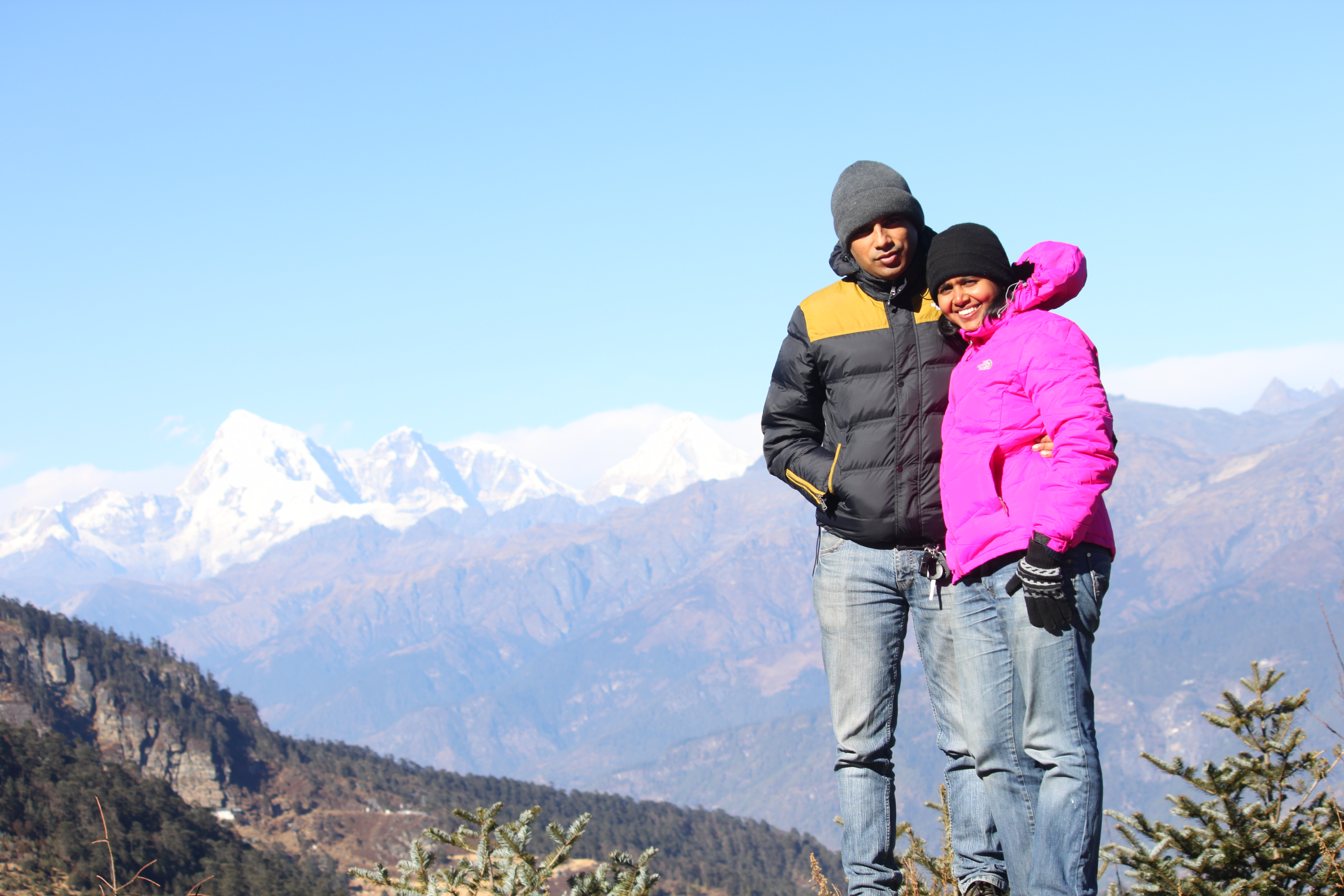
Enjoying sub zero temp at Chele-La pass
Finally we entered the main market area of Thimpu which is like the retail and hospitality hub. When there are scores of options of staying, it makes finding the right place at the right cost a difficult task. It took us some 45 minutes of searching and going hotel to hotel, we zeroed upon Hotel Druk Sherig to stay the night. The room at Druk Sherig was awesome and we would like to believe that we got the best room in the entire hotel.
Before I close the day, I would like to share that car parking is paid at the rate of 30 bucks an hour. And then, there are subtle negotiations. Slip in 10 bucks for a 15-20 minutes car parking. Most hotels do not have their own parking space, however, the managers are quite helpful to have the rates reduced to a fixed amount per day and multiple entries.
Day 5: Wednesday. December 26, 2012: Thimpu, Bhutan

Entry gate of Thimphu, Bhutan
It gets very cold in Thimpu during December and the night was no different. In the morning, we saw frost on each and every vehicle. Change in altitude translates to change in air pressure which means leaking jerry cans. This was not unexpected but a frozen jacket was. This is what would have happened – during our ascend and descend at Chele La, the change in air pressure would have forced some water from the jerry can to a fleece jacket in the car. Over night the water drenched jacket froze into a inflexible solid cloth rock. After a quick breakfast, we rushed to the Immigration office to get the permits extended for Punkaha and Bhumtang. The process was pretty easy, but locating the office was not. The office is located in a small building which can easily be missed if you look for it with a perception of being something big.

‘Buddha Point’, Thimpu, Bhutan
We applied for the extension and were asked to come back in a few hours to collect our documents. It was time to see Thimpu.
The statue of Buddha is located on top of a hill and it can be seen from almost anywhere in the valley. The Buddha point gives beautiful panoramic views of the valley and the statue is magnificent in itself. We spent some time here and we headed to the National Zoological Park of Bhutan. It was a bit tough for us to find the park and it was not really worth the time and effort spent. There were just three species of animals and those were just grazers. After the not so entertaining park visit, we drove to the top of the mountain on which the park is situated. From here, one can get a glimpse of the palace in which the royal family resides.
Back into the valley, we collected our permits and then we went to the post office and bought some stamps and from there we went to the Crafts and Art Market which was a makeshift marketplace opposite to the Indian Embassy. The crafts market provided excellent fodder for us shutterbugs. By evening, we were done with the crafts market and decided to check out other market places of Thimpu. We dined at Musk and the food was horribly bad, even though the eatry looked quite good otherwise.

Bird’s eye view of “Thimpu’ city..
Day 6: Thursday, December 27, 2012: Thimpu, Bhutan – Punakha, Bhutan – Thimpu, Bhutan
While checking out of the hotel, we were made to realise that we were also supposed to get our road permits extended to take the car into Punakha. It came as an unplesant surprise and it looked as if we were going to lose half a way waiting for the documentation to be completed. The road permit is given by the Department of RST located near the bridge. There is ample parking facility and the officer who issues the permit sits in the first room on the left. Government offices in Bhutan requires everyone to be dressed in formal Bhutanese clothes but this rule does not apply to foreigners. The young officer gave us the permit to drive to Punakha and Bhumtang within minutes and no time was lost. We started our journey for Punakha and the route was quite busy and we were to find out only upon reaching why. 30 km towards Punakha from Thimpu, we reached the famous DochuLa. 108 stupas are built on the peak of the Dochula to honor the Bhutanese soldiers killed fighting Indian rebels in 2003. and is one of the main attractions of Bhutan.

Dochula Pass-108 stupas (a piece of marvel in itself)!!
Closer to Punakha, a caravan of cars approached us from the opposite side. From the beacon lights it was quite clear that the cars were carrying some high profile officer of the Bhutanese government. To our pleasant surprise we saw the Queen sitting in the front seat of one of the cars. Since the road was narrow, the convoy slowed down and we had eye contact with everyone in the convoy including the Queen. One may wonder how on earth we recognised the queen. Every establishment in Bhutan, be it a small run down place has a framed photograph of the king and queen. And this way, one recognises them any where they can be seen

Punakha Dzong
We reached Punakha around 2 pm and found that the approach road to the Punakha Dzong was packed with people. A cop told us that a festival is under progress and people from all over Bhutan have come to take the blessings of the monks and the queen left few hours ago. The crowd was quite disheartening and we decided to give Punakaha a pass. There was no decent rooms available in Punakaha or nearby towns. We decided to drop Punakaha and Bhumtang and spend the night back at Thimpu. Now, the challenge at hand was to locate a payphone to call up the hotel in Thimpu to book a room for us.

About to enjoy a meal at the hotel in Thimpu
No payphones existed anywhere and there was no subscription in our cellphones. Two boys at a shop offered to help. They went to get cash loaded in their phone only to allow us to make a phone call – it is quite touching to experience the hospitality Bhutanese extend to complete strangers. Back home, no one gives a damn even if someone is critically injured in a road accident. And here in Bhutan, everyone was so nice and helpful.
We started back for Thimpu around 4 pm. The sunset at Dochula was so beautiful that it was worth coming back to this place. We reached the hotel around 8 pm and called it a day.
Day 7: Friday, December 28, 2012: Thimpu, Bhutan to Mirik, West Bengal, India

Glistening lights of nearby towns enroute to Mirik
The day we returned to homeland. Though we still had time on hand, we decided to go back to India and see parts of West Bengal and Bihar. We started early and reached India around noon. Once again we had to cross the dreaded stretch of road from Hasimara till Binnaguri. Even though we were on the road, we did not have a destination in mind. We toyed with the idea of going to Nathu La, Sikkim or staying a night at the famous Asiatic one-horned rhinoceros sanctuary at Jaldapara, West Bengal. Sikkim was out as we learnt a permit is required to drive beyond Gangtok and we did not want to rush the place.
While we were contemplating where to go next, Jaldapara sanctuary passed on our left. We stopped by and tried to book a ride into the sanctuary. To our disappointment, we were told by the officials, that they were booked for the new year weekend and there was no way we could be accommodated. We made several attempts with various officials explaining that we had come from New Delhi just to see West Bengal but all efforts were in vain. Disappointed, we continued our journey ahead and decided to go to Mirik.

A house at Mirik
We reached Mirik after sunset. From Siliguri to Mirik the drive was quite surreal. We were driving on a winding road with tea plantations on both sides of the road. In the distance we could see several hill towns and they looked like pieces of diamond jewellery. The sparkling lights in the distance coupled with a cold winter evening breeze was quite refreshing. Finding a bed to crash for the night was not difficult at all. Just at the entrance of the town is Jagmeet hotel – a decent place to get refreshed for next day. Around 8 pm, the town was completely deserted and it felt as if we have stepped out after midnight for a stroll.
The night in Mirik was quite cold and next morning we woke up to find frost on the roof of our car.
Day 8: Saturday, December 29, 2012: Mirik, West Bengal, India to Rajgir, Bihar, India

Amidst the mountains & tea gardens
Mirik is famous for its tea gardens and its orchid plantations. And after breakfast we went to see orchids. Orchids from Mirik are flown to New Delhi and are put up for sale. We followed directions given by locals and few signages on road and came upon a farmhouse. The place looked like a private residence and we sought permission to enter from the first person we spotted. We told the gentleman that we wanted to visit the orchid plantation which should be in the neighbourhood. The owner invited us in and showed us his farm. We saw turmeric being harvested along with various fruits which we had never seen before. He shared that the orchid farm belonged to his wife’s brother and he called for his daughter to guide us to the place. From the daughter we learnt that the uncle’s farm was less than 200 meters away. She took us to a house and asked us only to converse in Hindi with the residents.

Orchids at Mirik
The orchid plantation was beautiful. The owner was kind enough to allow us to use his garden for photography. Also, he explained us the life cycle of the orchid plants. We thanked him and headed for the tea plantations which were on the same road through which we had come the previous day. At the plantation we bought some local tea and headed for the plains. We estimated that we could reach Nalanda or Rajgir by nightfall.
The sun was about to set when we were crossing the Ganga bridge near Bhagalpur. We came across bad traffic and narrow lanes in Bhagalpur. At dusk we managed to crossed the town and now we were passing through villages of Bihar. Anxiety was building up as the stars started showing up in the sky with more than 150 km to reach the destination. If I remember correctly, we approached a four lane toll road after Sultanganj. This was a sigh of relief. Around 7 pm on this road we experienced dense fog which killed our speed. And, then it was Bihar we were driving through – one can never be sure if someone

Monastery at Mirik
would not be driving in the wrong lane coming head on towards you.
At Lakhisarai, we saw a signboard which asked us to turn left for Ragjir. So did the Google Navigation system running on our phone. What happened next was the most scariest part of the journey.
Google asked us to turn right towards a narrow lane and the map displayed that it will take us out of Lakhisarai. We were a wee bit skeptical to ask locals about directions as we did not want to give away the impression that we are tourists and lost after dark. Bad childhood perceptions about Bihar were overshadowing the rational thinking. This road led us out of the town but on a broken road with no street light and not a single vehicle. We did cross a couple of men carrying guns.

Tea Gardens of Mirik
This totally freaked us out. We both had read about cases where people have lost their lives blindly following GPS navigation systems which are perfect. We were better off letting people know in Lakhisarai that we were lost than to continue ahead on this broken deserted stretch of road. We took a U turn and headed back for the town.
There we asked the locals on the route. We learnt that the road we had taken had now been deserted as a better road was built few years back and we were asked to take this road.

Roads snaking through tea gardens
This road took us through Sheikpura, Barbhiga, Bihar Sharif. Closer to Nalanda we read online that Rajgir was a better place to stay than Nalanda. And so we headed for Rajgir. We found a okay place to stay for the night and decided not to act pricey accept what is available.
Day 9: Sunday, December 30, 2012: Rajgir, Bihar-Nalanda Bihar-BodhGaya, Bihar- Kanpur, Uttar Pradesh

Ruins of Nalanda
Next morning we realised that unlike Rajgir, Nalanda town is a bit off the main highway. Nalanda is as an ancient centre of advanced learning. It has a marked influence of Buddhism and at the early hours of Sunday morning on the lawns we saw Buddhists offering prayers together. From the ruins of this ancient university we headed to the museum and finally to the temple of Black Budhha.
We decided to stay the night at Neha’s parents house in Kanpur. On the way to Kanpur, we crossed Bodh-gaya and halted for lunch. We took a drive in this holy town and felt that a short 1-2 hour investment will not do justice to this place. And Bodh-Gaya entered in the list of places we would visit and spend quality time. We reached Kanpur around midnight.
Day 10: Monday: December 31, 2012: Kanpur, Uttar Pradesh to Gurgaon, Haryana

Last sunset of 2012!
The last leg of the journey on the last day of the year 2012. The time to go back home had come. We started from Kanpur 11:30 in the morning and took the regular route via Yamuna Expressway towards Delhi. However, we took a detour towards SH22A to bypass Delhi and took the Palwal, Sohna Gurgaon route. We were home by 7:30 in the evening, just in time for the new year bash.
Bhutan is a beautiful place. The beauty is just not scenic but also in its culture and people. People are happy in this landlocked Himlayan kingdom. I sometimes wonder, if it is a viable model for countries to operate in this global era. My spouse did not experience one incidence of letching in this country. No one tried to take us for a ride because we were tourists. We were treated with respect and patience every time we asked for information and directions. We Indians boast to follow the code of conduct of the Hindu culture of “Atithi Devo Bhav” (which means Guest is God), but do we really treat our tourists as God? We have lots to learn from our neighbourhood kingdom of Bhutan. They know how to be happy and they have quantified happiness. Is it not happiness that is being pursued by each one of us?
Special thanks to HV Kumar, Neeloy Sarkar & Kaustav Saha for route guidance before and during the trip.
Liveliness of Pushkar with Royalty of Jodhpur!

Colours of Pushkar Fair
On 25th November 2012, we celebrated our third wedding anniversary and for the last 2 years we have been meaning to see the famous Pushkar fair. The first year of our married life, Pushkar fair happened around our wedding day, so obviously we missed it. The second year, we had rescued few stray dogs a month earlier and their care was a priority that time. This year, we decided, we will go ahead with it.

Participants of Pushkar Fair
Only when we decided to finally make it to Pushkar for a weekend, we researched more on it and realised that it was not a place where we would like to spend more than a few hours. A cattle and camel fair looks amazing in the many beautiful photographs that keep getting circulated post the fair; but to be honest, we could not be in such an environment for more than few hours. Another problem was accommodation. Most affordable accommodations in Pushkar were sold out and the luxury tents were way too expensive.
We toyed with the idea of pitching our own tent at Pushkar but being a high traffic area, especially at the time of the fair, it was not wise to do so. People from all walks of life flock at such places and it would have killed the fun of camping anyway. We checked Google Maps for nearby cities where one can stay at comfort without shelling a fortune.
Avid road travellers such as us, believe in crashing for the night at a comfortable, clean and safe place rather than a luxurious stay. We get the kick out of driving through the country and not staying at exotic locations. It is the journey which adds value to our travels and not always the stay. This thought process made us reach Jodhpur on Google Maps.
Commitments at work gave us just two days for the trip. So we decided to see Jodhpur on day 1 and Pushkar at day 2.
Day 1: Gurgaon – Fort Khejrala – Jodhpur (Umaid Bhavan Place & Mehrangarh Fort) – 600 km

Khejrala Fort
As always we planned to start early to beat the traffic and crunch maximum miles the madness begins. We rolled out of our parking lot at 4 am and headed on NH-8. We crossed Jaipur in 3.5 hours and by 10 am we had crossed Ajmer. At Ajmer, we experienced heavy traffic at a railway crossing but still denser traffic jams were up on the cards. The road between Ajmer and Beawar are fantastic. Speeds greater than 150 kmph can be achieved on this stretch. At Beawar, when you turn towards Jodhpur, long traffic jams welcome you. There is another railway crossing where the road is quite narrow and one needs to wait in a long queue before one can regain speed. There is a better route to reach Jodhpur via Merta City which we took one our way back. Thanks to HV Kumar for this wonderful tip.

View from top of Khejrala Fort
Fort Khejrala – A few scores of miles after the town of Bilara, we reached the T-junction where the a Village Road merges to the State Highway. A big hoarding by the management of Fort Khejrala is erected here and it is difficult to miss it. After taking a right hand turn, we travelled for about 12-14 km on this narrow village road. The road is well laid but not broad enough. Two vehicles can not pass each other without one getting down on the left shoulder. After reaching the village of Khejrala, we took a right hand turn and climbed up the still narrower street and we arrived the gates of this centuries old fort. This has been converted into a heritage hotel and tariffs begin from INR 8000+ (in the year 2012)
The terrace of the fort provides a panoramic

Umaid Bhawan Palace
view of the terrain below and in a distance we could see as far as the city of Jodhpur. The staff at the fort shared that on clear days one can see the Mehrangarh fort from the premises. We spent about an hour at the fort before we resumed our journey.
Umaid Bhavan Palace – We reached the Umaid Bhavan Palace at 3 pm. There is a parking lot available at the fort entrance and the cost of entry into the palace is INR 25/adult. The palace is more of a museum which highlights the life and ancestry of Maharaja Gaj Singh. It boasts of a beautiful blend of modern architecture with a blend of Rajasthani culture. Here on, we headed to the Mehrangarh Fort.

Mehrangarh Fort
Mehrangarh Fort – To reach this fort, we had to go through the old city of Jodhpur and ascend up the hill leading to the fort gates.

Artefacts in Mehrangarh Fort
There are two parking lots – one 100 metres before the fort and one closer to the fort gate. Keep driving till you reach the second parking lot. A strange observation at the ticket counters was that one which displayed the prices in Hindi was selling tickets at a cheaper rate than the one selling tickets with prices displayed in English. Audio guide is available at the counter which we would strongly recommend. There is an elevator facility as well (for a small cost) at the fort entrance. Walking, however is fun and offers a lot of photography opportunities.
This is a better place to see compared to the Umaid Palace museum. It gives an opportunity to walk through the fort and see the entire place. From Mehrangarh, one can witness the blue city of Jodhpur. We spent around 2 hours at the fort and it was closing time. Thereafter, we went to the area where the canons are placed and watched the sunset.
After the Mehrangarh fort, we checked in to Dhillon House – a B&B near the Circuit House. We found Dhillon House through TripAdvisior and the good ratings given well justified. We had Lal Maas for dinner at a resturant recommended by Mr. Dhillon himself called On the Rocks.
Day 2 – Jodhpur – Pushkar- Foy Sagar Lake – Gurgaon 650+ km

Jodhpur City painted in Blue
After travelling more than 600 km and visiting three forts, we went into a deep slumber at the Dhillon House. We checked out around 10 am and had breakfast at one of the local shops of Jodhpur near Nai Sadak.
We wanted to avoid the traffic jam at Beawar and thus took the Merta City route suggested by HV Kumar. This route turned out to be amazing. Expect for 500 m of super bad roads (which were under construction) the roads are good and traffic light.

Horse for Sale in Pushkar fair
Around 1 pm, we entered the city of Pushkar. There is a RTDC village opposite to Pushkar fair grounds where parking was available. After having lunch at the RTDC restaurant we headed for the fair. The beauty about Pushkar fair lies in the colours of Rajasthan.
We spent a couple of hours at the fair, took a camel cart ride and then we started back home. Just after we crossed the city limits of Puskhar we came across a small ghat section overlooking a lake. Modern Rajasthan boasts of many man made lakes and no longer qualifies as a dry desert. We stopped over for some photographs and proceeded for home. A few kilometers ahead, we came across a sign board which said right turn for Foy Sagar Lake.

Explorers reviving memories of eating Sugarcane
Then through the narrow lanes we snaked our way to the Foy Sagar Lake. The Lake just pops out of no where and is beautiful. I do not know if it a camping site, but to me it appeared as a place where one can pitch in their tents and have a camp fire.
Once again, we started back home and continued till Jaipur. Back in August 2012, Jaipur to Delhi drive took 8+ hours and we did not want drive a snail pace. Therefore, we decided to go via Alwar and then via Bhiwadi- Sohna to Gurgaon.

Foy Sagar Lake
The roads are good till Bhiwadi, though quite often speed breakers keep troubling. The Bhiwadi- Taodu-Sohna road has less of traffic but small patches are extremely horrible. Over all we managed to cover Jaipur to Gurgaon in 5 hrs and 15 minutes.
One thing that Neha and I realised during this trip was that, there should be a will to go and see places and time can usually be managed. A trip which usually takes 3 to 4 days, we squeezed in 2. Many people would sneer and criticise this kind of trips but then at the end of the day we enjoyed every moment of it and were completely refreshed by the end of it.
Soaring between the mountains

We humans have always been intrigued by the flying birds and many men gave their lives in desperate attempts to learn to fly. With the advent of physics, we learnt about aerodynamics and this finally helped us to defy gravity. I remember as a child, at the sound of an approaching aircraft, rushing out of the house looking at the flying objects in the sky. Have we all not wondered and desired to fly like birds in open. Have we all not wished to have the magical carpet of Alladin or the witch’s broom or to fly with a fairy or to meet Superman in person. Alas, these are all fictional. Finally, fiction transformed into reality when like a madman, I ran towards the edge of the cliff. As your feet leave solid ground, gravity comes into action and you begin to descend. And, then you realise the paraglider that is attached to you is pulling you away breaking your fall, ascending higher and higher like an eagle. You are not inside an aircraft but this time in air not controlled by machinery but we humans.
 Our trip to Billing, Himachal Pradesh back in June 2012 took a backseat when we decided to go to Chakrata instead for spelunking. This was a long overdue trip. Billing is a famous paragliding destination in the world, second to a site in Philippines. Indian festivals tend to create long weekends, and such opportunities are not to be missed. The Diwali of 2012 was on a Tuesday, which meant that if you take one day off on a Monday, one ends up with at least 4 days to roam around the beautiful planet we call home.
The mighty beast- our new Scorpio was a recent addition to our home  (06/November/2012) and this added a set of bells and whistles to this trip. We started our journey from Delhi along with my Mom, Brother, his fiancée. My dad backed out last minute. Mom had recently joined a teaching at the Sherab Ling Monastery and thus, we were to stay at the monastery guest house. We took Una – Palampur route to reach Baijnath. On the Baijnath-Joginder Nagar road, one has to take the road leading to Bhattu village and drive for about 7 km before you are greeted by the Tibetan prayer flags. Keep moving till you approach a setup which transforms into a scene from a fairy tale; ones that start with “In a land far far away, in the middle of a dense forests lived few monks. Their forests had prayer flags all over the road which lead to their temple. The monks believed
  that these flags will guide the lost souls to their abode.” Of course Google Maps is of little help on this road.
The Palpung SherabLing Institute just pops out from the middle of no where and it boasts of an architecture worth admiring. We reached this place after dark and being a lone establishment – there is nothing much you can do after the natural lights go out. We ate at the restaurant/canteen of the Palpung Institute and then retired to our rooms.
Delhi and it’s surrounding cities were under a blanket of a dense smog which was adversely affecting the lives of the residents and my sweetheart Neha also came under the influence of the gas chamber. She was experiencing breathing troubles which simply vanished when we reached Sherabling. The air is super clean and our lungs were in for a treat.
Aloo paranthas (freshly baked bread stuffed with mashed potatoes) can be obtained anywhere anytime. They are like this cross cultural food adopted by all. During all my travels, local cuisines may not be available at a particular hour, you never fail to find aloo parantha readily available. While we were having breakfast next morning at the Stupa Guest house, we saw two gliders flying. The entire family got pretty excited for the adventure sport we were about to undertake.
 Before starting for Bir, we got the number of the paragliding operator from the manager of the SherabLing Institute. Kamal & Pinku (+91-9816925470) were the operators we were referred to. Pinku had a podium finish in the October 2012 paragliding championship which was held in Billing. On the way to Bir, we stopped multiple times for several Canon & Nikon moments.
We had some trouble finding the Bir landing site – we had bypassed it as the direction boards are misleading. It is better here to ask the locals about the landing site. We parked our vehicle at the landing site and took their Innova to the take off point. The take off point at Billing is about 14 km by road and it takes a good 25-30 minutes to reach there. It was warm at Bir and we made the mistake of leaving our woolens in the car. Even at Billing we did not anticipate the bone chilling cold that was in store for us once we were airborne.
At the launch site, we saw many foreigners undertaking solo flights, wearing special suits and geared up with GPS and other gadgets. We all anticipated that we might feel a bit cold in the air. Some local shared that these solo fliers fly for hours at a stretch and thus they need to be geared up and for a short tandem flight, we need not worry. Worrying wouldn’t have helped either – it was impractical to climb down 14 steep kilometers and then bring the warm clothes back here.
 Soon we were ready for take off – Mom was the first to fly, followed by me, then my brother, then his fiance and Neha was the last one to fly with the best pilot of the lot, Pinku. We had one GoPro camera with us, which I mounted on my helmet and we hired one GoPro camera from the operators which Neha took along with her. The DSLR and the point and shoot were of little use here.
The moment I was airborne, I felt funny in my belly – it is the same feeling that one gets on a roller coaster. Within a few seconds the feeling goes away and then you begin to ascend, taking advantage of the thermals which peak between noon and 2 pm. The increase of altitude results in sudden decrease in temperature and along comes the realisation – why I am under-dressed! It’s too late to complain so I decided to enjoy every bit of it.
Many times during my flight, I was flying above the birds and twice an eagle was flying so close to me that I could do a morphology study on the avian. My pilot took me for a cross country tour of the area and we covered two ridges. Couple of times, I spotted my brother whose red helmet was visible from quite a distance, but I could not spot Neha in the several gliders flying around. My pilot told me that the best time to glide is late September, October and early November as the weather is quite stable during these months.
 During my flight, my pilot wanted me to have the experience of some stunts he liked to show off – and then after taking my consent, he began to roll the glider. I could feel the increase in the G forces and we began to spin rapidly. This lasted for a few seconds. Paragliding is very noisy; the sound of the air is near deafening at times. At the end of this so called stunt, everything went quite for a moment and I felt completely weightless. An awesome feeling. After about 35 minutes or so, the pilot took us towards Bir’s landing site. We were still at a great altitude and then he said it again – ” Shall be repeat the stunt”, but this time it’s going to be much more fun”. I consented to it once again as I thought it would be just the same. And boy, was I wrong! We began to spin with immense speed. The G forces were clearly felt this time. I could feel blood rushing to my feet and the pressure of the blood rapidly increasing in my legs. Within a split second, I remembered all the shows on Discovery and Nat-Geo where they talked about fighter pilots
  passing out due to extreme G forces. At one point, I felt that my legs could no longer bear the outward pressure of my own blood and will burst out. I just hoped that I pass out before that happened. But nothing of that sort took place. I did not pass out nor did my legs explode. What happened was, we descended too quickly. We landed in the next five minutes and I enjoyed every bit of the flight
Mom had already landed. The cold and the flight made her sick so she rested while others landed. I could only spot Neha when she was landing and took a video of her landing. Each one of us, had an awesome experience of the flight and unanimously we regretted not taking the warm clothing along with us. Hereon, we went to have lunch. The trio – Mom, Bro and his fiance had to leave for Delhi by bus the same night from Baijnath. Later that evening, Neha and I came back to our room and we went into a deep slumber after an exhausting day.
Next morning, we headed for the Sherabling Monastery where a monk gave us a personalised tour of the place. After the monastery tour, we headed for Barot.
 Barot is famous for its trout farms and is a famous angling destination. It is about 35 km from Baijnath on the Baijnath Mandi road. We reached Barot by 3 pm only to find out that the trout farms are closed for breeding season and angling is not permitted till March 2013. While we were contemplating on heading back to Delhi, we spotted a nice wooden hut of the PWD Guest House. Upon inquiring from the caretaker about the accommodation, he told us that the rooms need to be booked well in advance from Jogindernagar. He suggested that we should call up the booking office and attempt a telephonic booking. We did and we got a room – of course we had to get a room, there were no tourists around a day before Diwali. The caretaker, then advised us to go on a drive 14 km ahead of Barot and admire the scenic beauty. We spotted couple water falls on the way, a minor water crossing and grazing grounds. We were back in Barot before the last light of the day disappeared into the approaching night.
Ate trout fish for dinner from one of the local restaurants and then headed back to our room. It was very cold in Barot – at about 8 pm, the temperature was around 4 degrees Celsius. We started back home next morning around 5 pm and we were back in Gurgaon for Diwali at 3 pm. This was by far the best Diwali vacation we every had.
Though paragliding is now checked off from our bucket list, we would certainly like to do it again – this time with proper clothing and a two way radio strapped on to us. We really missed each other for that 1 hour we could not spot each other. I found out today that there about several paragliding destinations in India, Billing just happens to be the best of them. It is a very safe sport, especially if it is done along with an experienced pilot.
Incredible India!
A Monsoon Ride…
For most parts of the country, the beginning of Monsoons mark the end of the tourist season and we chose this time of the year to travel by road. Our initial plan to complete a 7000 km circuit and touch the southernmost tip of mainland India (Kanyakumari), came to a dreadful halt near a small town called Dabra on Aug 10, 2012. Since we got together, we do not remember a time when we hit rock bottom. Now, we were faced with two choices, one- to mull over the unfortunate incident or re-plan So, like the phoenix who rose from its ashes, we decided to make the best out of what was left of our vacation. So we picked our other vehicle which was a Petrol Car and reworked the fuel expenses and eventually decided to drive up-till Goa only. In the initial plan, Goa was just one of the halts and no way we could have seen Goa the way we did. In one way, the journey was one of the longest impromptu trips we had ever taken.
Day 1, 13th August 2012- Gurgaon – Nashik, 1250 km in 19 hours

The surface of the roads starts to mimic craters on the only natural satellite of our planet. Every now and then, one is punished for not driving a Moon-buggy. Hardly 2 km on the road, our loaded car went into one of the craters of Gurgaon road and it resulted in two loud jolts. We stopped. With a sinking heart, Neha’s foot pushed the accelerator pedal towards the car floor – something had changed. The car had not come out unscathed, the silencer took a blow. The sound of the car’s exhaust had gone a whole octave lower. There was more bass, more masculinity in the sound of the car now. The sound was exasperating, however, we had no choice but to live with it. To our understanding, the crack in the belly of the silencer would have only cause temporary discomfort, till the point our brains filtered out the background noise. With this interruption, we now decided to move towards Jaipur. We would have wasted 10 minutes deciding the approach to Nasik and now we were moving towards National Highway 8.
Automatic Position Reporting System or APRS in short, is a real time tracking system developed by Amateur Radio operator WB4APR, Bob Bruninga in 1982. With the recent advent of a-GPS technology in cell phones and the freedom Android operating system gives, an application APRSDroid was developed which enables real time reporting of speed, bearing, altitude and location interlaced on Google Maps on http://aprs.fi We realised around 5.30 am that we had forgotten to switch on the APRSDroid application and by this time we had covered almost 70 km. One more realisation happened around 8 am when we were bypassing Jaipur – the cigarette lighter socket was not functioning. This meant that we could not charge our phones and this was not good at all. We halted and went down on the car, diagnosed that the fuse was missing (could not figure out why the fuse was not there- the crater incident?) and installed a new fuse and we were good to go.

Grasslands
For breakfast, we had mutton biryani which Neha had cooked the previous night, keeping the trip in mind. By noon, we were cruising towards Chittorgarh when incessant rains lashed upon us. Unnerved by it, we continued our journey, though at a reduced speed as visibility dropped significantly.
The transition from great to worst road conditions can be profoundly experienced on this stretch. As soon as one takes the clover leaf to move towards Nasirabad, the requirement of the vehicle changes from a sedan to a hovercraft. This part of the road was low lying and partially flooded which made the conditions a degree higher than worst. A bird’s eye view of the road below would have been like an army of angry ants marching towards a destination. The condition of the roads continued till we reached Nimbahera bypass. The bypass is via MDR 11A and eventually it meets NH 79 once again.
Around 4 pm, we had reached Lebad after crossing Neemuch,

Mandsaur and Ratlam. We were to go first towards Pithampur and then to Manpur. However, we came across a newly laid road (which as per the Google maps was only a partial road) and it helped us bypass Mhow and Pithampur and we reached Manpur.
By 7.30 pm we were 130 km from Dhule and our ETA to Nasik was 11.30 pm. We reached Dhule at 9.30 pm and by 11.30 pm we had entered Nasik. We had covered 1250 km in less than 24 hours on Indian roads and this was a feat in itself. What made it even more exciting was the monsoon season, which makes driving tough and the HVK members who were tracking our every single movement on road via APRS. The active route consultation with HVK members was not only helpful but superbly fun.
We checked into Hotel Sai Saya arranged by Neha’s schoolmate, Rahul Bajaj and then we went into a deep slumber owing to non-stop driving of 19 hours! Who thought that we will wake up in Gurgaon, Haryana and sleep in Nasik, Maharashtra the very same day.
Day 2, 14th August 2012. Nasik and around
We were up by 8am and got ready for a much relaxed day. Wheel alignment and balancing was one of the important agendas of the day due to the minor incident the previous morning. While we were getting ready to move out, we met, Rahul Bajaj, who guided us on the local garages. After getting the car fixed, we headed to Ozar, a Hindustan Aeronautics Ltd (HAL) township where Neha spent her childhood.

York vineyard, Nasik
We revisited her school and happened to meet one of her teacher from her school days. She told us that she was going to retire in the next few months. After a few Canon moments we headed for Pimpalgaon, where Neha lived for sometime before moving to the township. We saw the house her family rented and had a chance to meet the building owners as well. From here we headed back to Nasik and met Rahul en-route the vine

Waterfall, Nasik
yards. He came along with his family to York Vineyards and we had some nice wine tasting moments there. The taste of wines still is fresh in my memory as I write these lines. Later that evening, we had traditional food at one of the theme restaurants – Sanskruti and then retired to our hotel for the night.
Day 3, 15th August 2012 – Nasik to Belgaum, 600 kms
We drove throughout the day. The initial plan was to touch Goa and visit Belgaum on the way back, but then I did not want to cross the Belgaum – Goa stretch at night, as I always wanted to show Neha the beautiful landscape on this route. Thus, we decided to halt for the night at Belgaum. We crossed Pune in 6 hours and got badly stuck in the heart of the city. Ideally we should have taken the NH4 bypass but a series of confusions arose when we took a wrong turn and the navigation system when clubbed with inputs from the locals forced us to drive to what I would term as Chandni Chowk of Delhi. After Pune, we stopped over for a nice lunch at a roadside eatery called Mama. This was around 3 pm. From Pune to Belgaum, we found some very good roads and we had touched Belgaum around 8 pm.
 I studied engineering in Belgaum and when I left this city in 2003, the roads of Belgaum were something. This place receives rain for more than 6 months in a year and most of the potholes are filled with reddish muddy water. Nine years later, the Belgaum – Pune road had a new eight lane by-pass which, if navigation had not alerted us, we would have zipped by the city. Somehow, we managed to find our way and entered the city through its worst patch – the Fort Road. It was time to test my long term memory now. A lot of reference points had not changed, yet, the city proudly shouted of the penetration of organised retail in India to tier 2 & 3 cities.
We checked into Uday Bhavan near Third-Gate. The city has 3 major railway crossings, colloquially called as Gates and these are such prominent landmarks that addresses are referenced against them. Next, we went out to have dinner at places where I used to eat as a student. It was disappointing to know that Uday restaurant and Pai restaurant had shut shops many years ago. We had the first sea food of the trip at Hotel Sea Rock, which was close to where Pai used to be there. After dinner, we drove around in the city and finally crashed into our hotel for much needed rest.
Day 4, 16th August 2012- Belgaum to Goa, 120 kms

K L E Engineering College, Belgaum
Next day, we woke up and found our room overlooking a house which was quite old and large. After clicking some photos, we got ready and had breakfast. We now, visited my engineering college – K. L. E. Society’s College of Engineering and Technology. Boy, it had changed, and changed a lot. The department of Biomedical Engineering had shifted to a floor above and everything was different. Met some of the old professors and chatted with them for a while. Now, I wanted to take Neha to the Punjabi Mess where I usually ate all those years ago. The couple who used to run the eatery had shut it down and shifted somewhere and we could not locate them. Next, we went to see the house
where I had rented a room and stayed for about 2 years. We met the lady of the house and she was glad to see us. We bade her farewell and headed towards Goa.
There are several routes to Goa that one can take- I never liked the national highway.

It was always too crowded and non scenic beauty on the way. The Amboli Ghat route via Sawantwadi is preferred route of my people, but not as beautiful as the Tilhari Nagar route. Before starting, we refuled and got the air pressure checked. Just when we turned left on the Belgaum Amboli road for Tilhari Nagar, we stopped to mount the GoPro Hero HD2 Motorsports Edition camera on the car and I saw that the rear left tyre was loosing pressure quite quickly. While I was examining the cause of this leakage, the nozzle broke into my hand and came loose. This was something, we were not prepared for. Our puncture kit did not contain an extra nozzle assembly and thus, we tied a wire on the nozzle and rolled toward Belgaum. We came across a few puncture repair shops but no one had the nozzle in stock. We continued to move towards Belgaum and finally found a shop which had the piece. After getting the tyre repaired, we restarted our journey towards Tilhari Nagar.
 The roads did not exist. It appeared as if there were roads millions of years ago and now just ruins remained to drive on. On this route we were totally cut off from the world, cell phone reception was not available and we were on our own completely. If the car broke down, we would have to wait for the next generous passer-by for help.
We reached Tilhari Nagar and had lunch at the small sleepy hamlet of a town. After lunch, we resumed our journey to Goa and soon we were on the popularly dreaded Ghat section. Before we started our descent we went off-road to a spot from where the entire view of the valley could be seen. There was a dense blanket of cloud and we were in it. It was quite windy and it started to rain  when we reached the spot and we could not stay there for long.
We entered the state of Goa around 6.30 pm. Two Amateur Radio Operators helped arrange our stay at a government accommodation near Panjim. We checked into the accommodation and then went out for dinner at one of the river side restaurants in Panjim.
Day 5, 17th August 2012- North Goa
 We started our day by driving down to Fort Aguada near Sanquelim beach. Years back when I used to visit Goa, a ship called River Princess had broken anchor and strayed ashore. It got stuck near the beach and was a center of attraction for many and an eyesore for few. This vessel had now been removed. We got some really good shots at the Fort which is over looking the sea. Thereafter, we went to the Lighthouse but the sun was too harsh and we decided to skip stepping out and burning ourselves. Next, we drove upto the Aguada prison, which I thought was a tourist attraction but was proved wrong. It was a functional jail. Anyway, we started back towards
 Calangute and had brunch. Then, we headed for For Tiracol which is at the northen most tip of Goa and one has to take a ferry to reach there. It was a good feeling to drive our own vehicle into the ferry. Tiracol fort has been turned into a heritage hotel and as expected of heritage hotel, the tariffs are exorbitant.
On the way back, we stopped at Ashwen beach and then at one of my favourite beaches – Anjuna beach. Here we had some sea food and relaxed for a while. By the time we moved and reached back to Calangute, it was dark. Had dinner at Calangute and headed back to the accommodation.
Day 6, 18th August 2012 – Anjuna, Vagator, Baga and Casino Royale

Visited the Anjuna and Vagator beaches. Trekked to the Chapora fort and then spent the late afternoon at Baga beach. After sunset, we went to splurge money at the live-floating casinos of Goa. The casnios have opened up receptions on the banks of the river Mandovi. A ferry takes you to the ship in which the casino is being run and the cover charge includes a buffet dinner along with unlimited booze. So, at a place where booze is the cheapest in the country, free booze would still bring immense profit in gambling. Neha had been to a casino is Nepal earlier but for me it was my first experience.

The initial few games, we doubled our money but after that we kept on loosing and loosing. Who knows if it is all rigged. After loosing a significant amount of money, we decided no more bets and called it a day.
Day 7 , 19 August 2012 – Vasco Harbour and Calangute beach
 We had one of the most amazing foods in Goa at the Sheela restaurant en-route the Vasco harbour. We had shell fish (clams) and had patole – a Goan sweetdish made out of rice and coconut and wrapped in turmeric leaf.
We saw a private ship building yard on the way and decided to stop over and check it out. When we came back, we saw that our front right tyre was low on pressure. Till this day, I feel that someone punctured the tyre on purpose – as I could not find the puncturing agent while fixing it. Why someone would do that, I don’t know.
After reaching the harbour, we found out  that the area where one could go earlier was no off-limits. We requested the CISF guard to let us through but he did not allow. He suggested that we could ascend the hill and look at the harbour from there. We climbed on the huge cemented walls and sat there for hours looking at the sea and later visited the place which was suggested by the guard. Later that evening, we returned to Calangute and spent many hours walking down the Calangute market and its beach.
Day 8, 20th August 2012 – Panjim Market, Spice Plantation and Palolem Beach
 We were moving out of the accommodation which was arranged by our friends and migrating south. I knew that an amateur radio operator lives in the vicinity and I wanted to meet him before we left. The caretaker of the guest house had no clue about VU2SMS. Luckily, I ran into a gentleman who called up Manju, VU2SMS. Manju, took us to his home and showed us his radio shack and also gave us a QSL card. We said 73s and started for Panjim market. We bought some gifts and then headed towards the Spice Plantation. We had some difficulty looking for the spice plantation. The plantation tour and the buffet lunch were worth every penny spent. The only disappointment was not being able to have elephant bath. The mahout who manages the elephant was on leave and hence could not experience elephant giving bath to people sitting on its back by filling water in his trunk. After enjoying the tour, we left that place and headed south.
We reached Palolem beach in the evening and checked into Hotel Draupadi adjacent to beach. Took a stroll in the evening and booked our self a boat ride next morning to Butterfly beach and Honeymoon beach. We had some great moments on the beach.
Day 9, 21 st August 2012- Palolem Beach
It was about to rain when we got up and our boatman asked to us wait for a while before he would take us into the water. We started an hour later but could not spot any dolphins. After some Kodak moments we came back. Thereon, we went to see the fort – Cabo-de-Rama. We trekked inside the runis of what remained of the fort and then checked out a couple of beaches in South Goa. Later, together we had some playful moments swimming in sea that evening. Thereafter, we bought booze to bring back home.
Day 10, 22nd August 2012- South Goa to Surat, 890 kms, 18 hours
Neha was feeling home sick and I could not get enough of Goa and its beaches even if we setlle there. I guess, she was stressed about the incident of 10th August 2012 as lot of money was at stake and thus she wanted to be back home. Between the two of us, I am the spendthrift and she is the banker. She would save and save and I would just want to spend and spend. Anyway, that is a topic for another blog post.
We started our journey around 4.30 am from South Goa and our target was to reach back home in 2 days. We took the NH17 till Mumbai and then NH8 from Mumbai to Surat. Reached Surat around 9 pm and we decided to break for the night. By the time we entered Surat city and checked in, it was 11.30 pm and we just slept.
Day 11 , 23rd August 2012 – Surat to Gurgaon – 1160kms , 22 hours
The wake up service, called at 3.30 am in the morning and after grabbing a quick breakfast of sandwiches and tea we were on the road once again. We took a detour at Baruch and crossed the Narmada from the city as on NH8 a 10 km long traffic snarl was building up. We reached Jaipur at 6.15 pm and it took us more than 8 hours crawling on NH8 to reach home. Another journey sucessfully completed with my sweetheart.
Even though the vacation did not go as per the initial plan, we still  covered 4600 km on a 12 year old petrol car. The car which has a mileage of more than 100,000 km did not give us any trouble except for wheel alignment issues twice which we gave ample warning to act upon. Isn’t this much better than a brand new lemon car?
The route we chose, sometimes by guidance of the HVK community and sometimes by missing out the correct roads, gave us a view of beautiful and green landscape. No photographs, no words can encapsulate within themselves the feeling that one gets when you step out on the green moors. The feeling when light drizzle tickle your body and fresh breezes kisses you- this is something to be experienced and only a monsoon ride can make you go through this!
Puneit Thukral
Greetings!
Thanks for visiting my page.
This blog encapsulates the fragments of my memory about events and phases of my life. I enjoy photography, astronomy, road-trips, ham-radio, tracking satellites, aquariums, off-roading, reading, gadgets etc. In fact, I am a person having vivid interests and wish to explore every aspect of life with my sweetheart – Neha.
Hope you enjoy reading my posts.
Cheers!!
Clustr Maps

Traveler Voice


