Archive
Road Trip to a ‘Happy Land’ – Bhutan!

This post attempts to express joy, adventure and happiness experienced during the road trip undertaken by Neha and I in December 2012 to the land where they quantify happiness in terms of GNH (Gross National Happiness). This Neverland is not far from where we reside. A 1600 km drive east of Gurgaon takes you to this place. Not only the place is beautiful, everything about this is peaceful, serene and happy. This place is called the Royal Kingdom of Bhutan. [Alongside, we will try to give as much info as possible to future travellers on the route, hotels, formalities etc.]
A road trip to Bhutan was not in the cards till a month before the trip. We were planning a trip from the time we brought home a 4WD Scorpio in November 2012. We wanted to go to Rajasthan or Lahaul Spiti valley. But as the year 2012 came closer to its last days, we made an impromptu shift in plan to Bhutan. Leaves from office are hard to get by and once they were approved (special thanks to our bosses), the first hurdle was crossed.

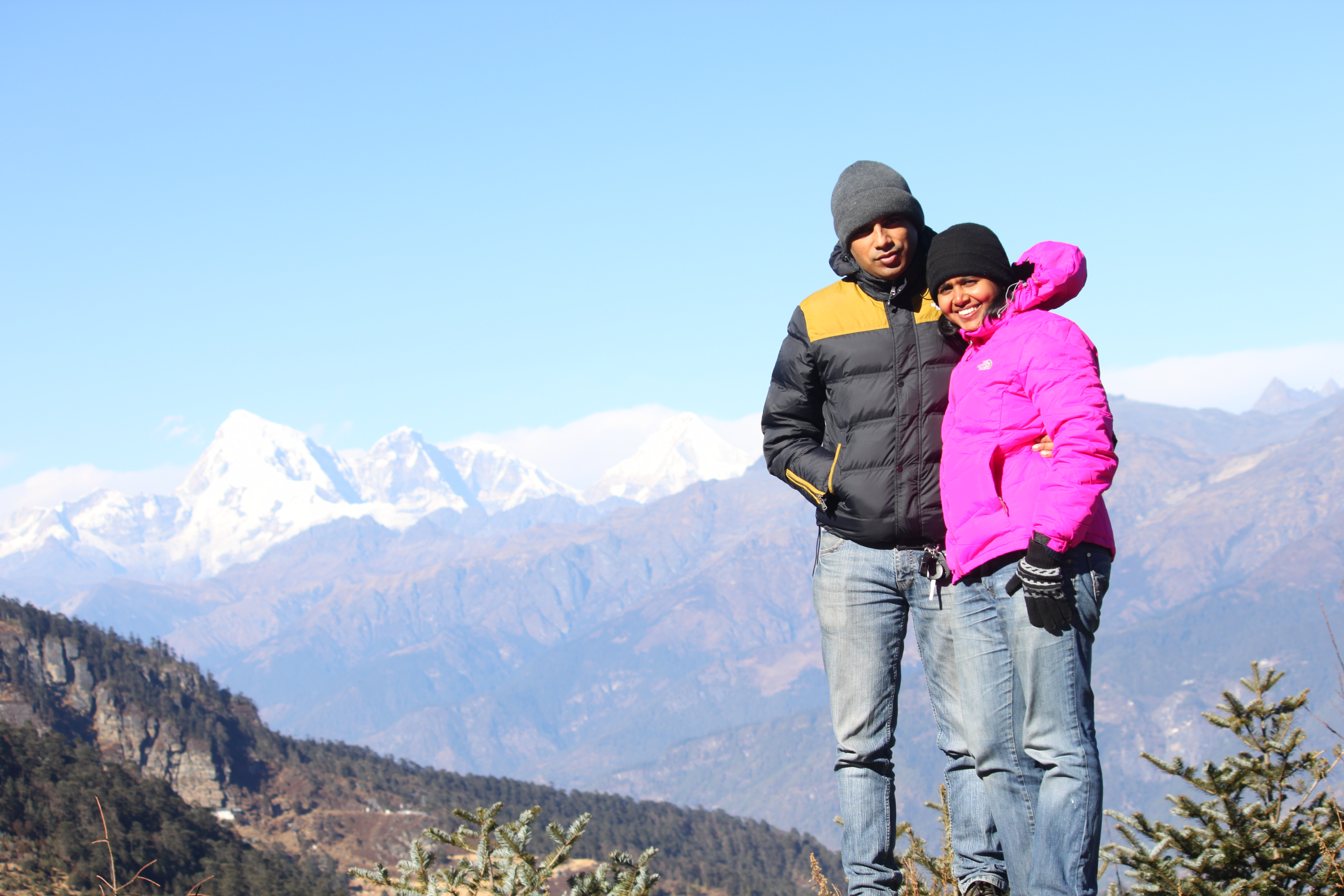
Euphoric bohemians at Happy Land
Day 1: Saturday, December 22, 2012. Gurgaon, Haryana (India) to Gopalganj, Bihar (India) [950 km]
All road trips begin with getting up early and this one was no exception The idea is start early, crunch most miles before the hustle bustle of life slows you down. December mornings are a wee bit different. The cosiness of the warm blanket is so comforting that it is not uncommon to oversleep. Nothing of that sort happened with us. We did get up on time, and made one final round of packing for the trip. The week before the trip was something. Usually, we do get time for leisure after a gruelling day at office, however, the preceding week was an outlier. Looking back, this reminds me of college days when we used to prepare the night before the exam. We started our packing for the trip, the night before as well.

Mustard fields of Uttar Pradhesh, India
People often express surprise to the frequent road trips that we undertake; therefore, packing a night before was not disastrous after all. We prepared food for one day, collected as much drinking water as we could and embarked on our journey. Fifteen minutes on the road, Neha suddenly recollected that we left our lunch on the kitchen counter. Damn! We came back home, picked up the food and restarted the journey. In about an hour, we reached the Yamuna Expressway. We figured out in our previous road trips, that Yamuna Expressway is the fastest route to Kanpur even from Gurgaon, though a bit longer distance wise. At the entrance of Yamuna Expressway, a signage welcomed us, which said “Heavy Fog Ahead, Drive Slow”. For the first few kilometres, the road was clear and then the inevitable was staring us in our face. Visibility dropped to less than 100 m at certain sections. Most people follow cars in front while maintaining sufficient distance between them. I get paranoid when it comes to such driving it is not uncommon to see accidents where such cars have crashed into each others like falling dominoes.
Fog gave us company till Kanpur and then the weather cleared up. We took a bypass for Lucknow and travelled through MohanLalganj and joined the National Highway at Barabanki. I am sure we would have saved a lot of time by avoiding afternoon rush of Lucknow. In fact, Google Maps took us through some of the villages of Uttar Pradesh and we made the best out of this opportunity by taking some photographs and stopping for a while.

Entering Bihar
By evening (6pm), we were at the outskirts of Gorakpur. Here we had the option either to enter Gorakpur city and halt for the night or take the bypass and enter Bihar. We chose the latter. By 7.30pm we had entered Bihar. We had been warned by HV Kumar and Neeloy Sarkar about the bad roads for 40-50 km after entering Bihar. However, we did not expect the road to end suddenly in pitch darkness. Had our vehicle been without ABS, the chances that we would have safely manoeuvred the diversion would have been bleak. The first city of Bihar we came across was Gopalganj and we decided to look for a hotel and not continue ahead. If only the roads were as decent as they were from Gurgaon to Bihar border, we might have continued ahead.
Gopalganj is a very small town is not a tourist place. Finding clean and safe hotels was an adventure in itself. A quick internet search gave us a list of few hotels and Hotel Bhaibhaw with the best reviews of all. We set Google Navigation to the hotel and learnt that it was sold out. Sold Out! Just our luck. Then we found another hotel and took the most expensive room at INR 600 a night. The most expensive room was way below our hygiene standards and we opted to sleep in our sleeping bags. Next morning, we felt more clean that the bathroom and decided to checkout and continue our journey.
Day2: Sunday, December 23, 2012: Gopalganj, Bihar to Phuentsholing, Bhutan [500 km]

APRS track- Gurgaon to Gopalganj
The night before, the hotel caretaker advised us to start our journey after 7 am due to foggy conditions prevailing over the last few days. By 6.30 am we were back on the road and targeted to reach Bhutan by nightfall. The road condition improved after few scores of miles and soon we were cruising on the East West Corridor. This stretch of road continues till West Bengal and is a very fast road. However, caution must be exercised as locals do not adhere to basic traffic laws and drive in the wrong direction and can be seen using the road to dry wheat, clothes etc. At places, especially where the road merges into a bridge, the condition is not as good and at times, one has to take sudden diversions. All in all, our two cents for East West Corridor is drive fast yet be very alert, specially when overtaking and if you see the vehicle in front of you suddenly changing lanes, which would 9 out of 10 times would mean someone is coming from the opposite direction in the wrong lane.
After Forbesganj, Google Navigation asked us to exit the East-West Highway

Entering horrible stretch of road (Entering West Bengal)
and take the state highway to West Bengal. We halted and calculated that the route would be 100 km shorter than the East West highway and even if roads are not too great, we would have not lost much time. Travelling is all about exploring. Following a fixed route and plan is more of commuting. And, we were driving for fun, for exploration and for adventure, so why not. Initially, it did not seem like a bad decision, roads were good and once again we passed through the villages of Bihar. At Bihar West-Bengal border, things changed and not for good.
We were preparing lunch in the car when we crossed the border and we felt as if we have entered a really backward place. Car kettle which is a boon to have become a hazard due to the craters on the surface of the road. Somehow we managed to reach smooth surface without burning us and stopped to have Kadi Chawal (Kadi is a yellow curry made in curd and gram flour and chawal is Hindi for rice). Ready to eat food comes really handy on such stretches of the country where good eateries are hard to find.
The road took us through tea gardens, our first on this trip. We hopped out for a quick photograph and then continued the journey once again. We snaked our way through the interiors of West Bengal. At that moment, the decision to take a detour from Forbesganj seemed not so great. The path once again brought us at crossroads – one road went to Siliguri and another towards New Jalpaiguri. The locals are mixed opinions about both the routes. New Jalpaiguri one seemed shorter and our guesstimate was that, we might get stuck in the evening traffic of Siliguri so we went ahead with the New Jalpaiguri route. This route had its own demons. Two kilometers down the road, we halted at a railway crossing where a huge traffic jam welcomed us. To make things worse, the crossing was undergoing repairs and even after the train passed, the gates remained closed for a while. After 20 minutes or so, traffic from the opposite side was allowed. I requested the traffic cop to allow us through as we had a long journey ahead – he complied. Even though we crossed the railway gates, our speed remained slow as the roads were horrible. While crossing the town of New Jalpaiguri, we passed a road that was 4 km from the Ind0-Bangladesh border. Few hundred meters ahead on our path, we were flagged down by cop who was not in uniform. We did not stop. The cop got into his Bolero and as he started to chase us, we decided to stop and find out what was the problem
Neha was at the driving seat, so he walked towards my window. The first thing I blurted out – we did not realise you are a cop as you were not in uniform. I saw his expression changing to a defensive mode. He asked where we were heading and if Neha has a valid driver’s license. He took our car registration certificate and went to his vehicle and talked to someone in the vehicle for 5-10 minutes. He came back and returned the car registration and said we were free to go.

Inching closer…
By night fall, the road surface had worsen and it felt we are riding a camel and not a car. Anyway, at Talipara, West Bengal, we intersected the road coming in from Binnaguri and now we were on the real track we should have taken. This did not mean end to bad road woes. I have already used the adverb worsen in the beginning of this paragraph and the path ahead was degrees higher that what we came through. At one bridge crossing, the bridge had a hole big enough to swallow one tire. The condition of the road gave us jitters. Just when we needed guidance, Kumar HV who was tracking us on APRS sent a text message came at 7.48 pm which read
Kumar HV: (7:48 pm) “Go for it, border gate closes at 10. Stay in Phuentsholing.”
Puneit Thukral: (7:52 pm) “24 km (still) left… horrible roads”
Kumar HV: (7:53pm) “Yes, road will be super from just before Hasimara”
This information from Kumar was great news and we proceeded on the crater laden road. As expected just before Hasimara, road surface changed and in no time we were at Jaigaon – the last town on the Indian side. A huge gate welcomed us into Bhutan and we entered Phuentsholing at 8:31 pm Indian Standard Time or 9:01 Bhutan Standard Time. We looked for a hotel for about 20 minutes before we found a good one for INR 1,300 a night. The hotel was called ‘Hotel Pelri’.
We had done it – we had self-driven to a different country. Wow, what a feeling it was. Indian mobile services have network coverage in few pockets of Phuentsholing. It was thus time to announce it to our family and friends of our arrival in Bhutan before the network coverage dwindled.
Phuentsholing is nothing like Jaigaon. Even though both the cities are separated by a wall, the is a remarkable difference in architecture and culture. It really gives you a feeler of a different country altogether.
Day 3: Monday, December 24, 2012: Phuentsholing, Bhutan to Paro, Bhutan

Majestic entrance of Bhutan
After sleeping like a baby in this beautiful and happy country, we woke up fresh and charged up. Post a quick breakfast in the hotel’s restaurant, we proceeded to the Immigration office to get our permits. Immigration permits are required to go beyond Phuentsholing and the Phuentsholing office gives permits till Paro and Thimpu for a maximum of 7 days. We were up early, as the sun rose early (we were in the east). By 8 am Bhutan time (from now on time will be in BST unless mentioned otherwise or when we enter back into India) we were at the office. This office is located on the right hand side after the petrol pump if you are coming from India into Bhutan. The office opens at 9 am and we were early. So we decided to take a stroll into India. The huge gate through which we passed into Bhutan is only meant for vehicular traffic. Pedestrians can cross the border but through a different gate. We entered our homeland once again and just like that the clocks went back 30 minutes 😉 In Jaigaon, there are street vendors selling the basic necessities of life while in Phuentsholing, street vendors can not be found. A wall can change a lot!

Welcome signage
Jaigaon is the last place where one can find ATMs of Indian banks and thus, we withdrew some cash. A lot of websites on Bhutan travel mention that Bhutanese merchants do not accept Rs. 500 currency note but it is not the case. As of December 2012, Rs. 500 notes were readily acceptable. However, it is good to carry INR 100 currency notes. Also, Indian currency is readily accepted in Bhutan at the rate of 1 Indian rupee equals 1 Bhutanese ngultrum at all merchants.

Enroute to Paro
After a stroll in India, we walked back to Phuentsholing and headed towards the immigration office (it is on the first floor). We filled up the forms for permit (available at the staircase with the guard). Along with the forms, we submitted one copy each of our identity documents (voter’s id, passport, drivers license are accepted). They took our photographs and asked us to come back in an hour. While we were waiting for the permits to be issued, we washed our car in the campus of the immigration office itself. After an hour, we got our individual permits (they are given free of cost). Next, we headed towards the Road Safety and Transport office (called us the RST office) near Phuentsholing bus stand to get the permit for our vehicle.

Bhutanese meal
The permit is issued from the first floor. However, photocopies are required of the immigration permit along with an application to apply for vehicle permit. The RST officer approves the application and directs to go and pay the permit fee. (Permit fee for SUV in December 2012 was INR 210.00) While depositing the fee, photocopies of vehicle registration, insurance and driver’s licence is also required. After making the payment, one needs to go back to the RST officer to get his signature on the Road Permit issued by the staff. Finally, a photocopy of the signed permit is required to be submitted at the fee deposit counter before the job is completed.
The whole process – right from immigration to vehicle permit took us about 3.5 hours and from here we proceeded to Paro.

Enjoying scenic beauty on the hills
Paro is the airport city of Bhutan and thus important. The drive for Phuentsholing to Paro took us around 4.5 hours. There are couple of immigration check posts where it is required to halt and get the documents stamped. Unlike India, it is required that the driver halts on his own and get the documents stamped. What will happen if one misses – I don’t really know. The bottomline is lookout for checkposts and ask them if a stamp is required. They are friendly people and won’t fleece for money.
We took a small break for lunch en-route and stopped at the local Bhutanese restaurant.

Warming ourselves with Kerosene Stove while awaiting food at restaurant in Paro
Initially there was a hesitation in the tone of the lady as she was sceptical being Indians if we would eat pork and beef. However, we were there to relish the local cuisines of the place. A delicious pork dish followed and we resumed our journey afterwards. The roads are very narrow for most of the route. The excellent road sense of the drivers in Bhutan shows on such narrow paths. Everyone willingly gives way to the faster vehicle even at the cost of bringing their own vehicle to a halt. We entered Paro around 5 pm and it was beginning to get dark and cold. Before we went scouting for a place to crash for the night, we decided to eat first. With our tummies filled with food, we began checking out hotels. We had a few names with us but they were either sold out or did not match our requirements.

‘Hotel Phunsum’ entrance
It took us awhile before we finalised Hotel Phunsum. Around 9 pm we decided to go for dinner in the same market where we had our evening snacks. There was not a soul on the road other than us, not even dogs. It was quite cold but then not cold enough to close everything at 9. We saw a light on the first floor of a building and it looked like a restaurant. Upon entering the place, we realised it was a residence cum restaurant and a group of people were watching television while huddling close to a kerosene heater. They were as surprised to see us as we were to find one ray of light which could provide us mortals some food. The usual reaction was presented before us -“No Indian food; It will take a lot of time to cook; Why don’t you walk across to the road and check out if something is available!” Don’t Bhutanese need to earn? Before leaving we forewarned them that we may come back in case nothing else is available.
Disappointed we headed to the road only to find the directed shop closing down. We once again went back to the same place and ordered some chicken, pork and rice. Piping hot food came after 25 minutes and we filled our hollow bellies with the delicious Bhutanese cuisine.

Old museum building…
When we finally came out, the temperature had hit the floor. No wonder the people closed their shops to return to the comforts of their warm homes and to the warmth of their loved ones. In the next half an hour we were ready to call it a day at ‘Hotel Phunsum’.
The first rays of the morning sun bathed our room when we woke up at 6 am. From the window of our room on the second floor we could see fields (paddy) towards the east which had a white reflective layer covering them. Neha and I speculated that is this frost or something else.
Over the night, the temperature fell several degrees below zero and the pipes had frozen leaving the taps were dry and cold. What a start of the day. The next hour was spent looking for the hotel manager and arranging few buckets of warm water. Finally by 8 am we checked out of the hotel and proceeded

Enroute to Chele-La….
for sight seeing. We went to the National Museum in Paro which is situated on a hill top. There are two buildings but the older building which can be seen from Paro town had been shut down after an earthquake made it weak. The entry fee for citizens of SAARC countries in December 2012 was Nu 25 per person. Photography is not allowed inside the museum and we were made to deposit our cellphones and cameras. The museum has artefacts depicting the history, culture, flora and fauna of Bhutan.
After our visit to the museum, it was time for brunch. We were back at the same market where we came for dinner the night before. At time of placing the order we were told that the food will be ready in 45 minutes, and this gave us time to check out the local shops of Paro. We picked up some few memoranda and clicked photographs. And then, we bade farewell to Paro and proceeded for the highest road in Bhutan – Chele La (pass).

Chele-La at 0km
To go to Chele La, from main market of Paro head towards Phuentsholing and a few miles after crossing the runway comes a bridge on the right hand side. After crossing the bridge take a left turn and one comes across few shops on the left. These shops are the last one can find until Ha valley. Also, there are no fuel pumps on the way, so it is a good idea to get a refill in Paro itself before starting. The roads wind up as the elevation increases and so does the cold. We came across frost and ice at noon a few scores of kilometres on this pass. Roads are quite safe and traffic was sparse when we travelled. A few miles before the Chele top, one can witness the magnificent Himalayan snow covered peaks. One of these peaks is the highest mountain in Bhutan. At Chele top, day time temperature was below zero and harsh winds forced us to wear an extra layer of clothing. Soon, we were descending the Chele La towards Ha valley and all the way to Thimpu. The other option was to track our path back to the bridge I talked about above and then go to Thimpu on the Thimpu Paro highway.
At Ha valley we passed by establishments which looked like military training grounds. We did not enter the Ha town. By dusk, we were close to Thimpu. Thimpu is the capital city of Bhutan and the most commercialised. There is speed limit of 50 kmph on major roads of Thimpu. This is not only well marked but also real time speed checks are installed at every few kilometres. It makes sense to adhere to the speed limits, especially if you are a foreigner.
Enjoying sub zero temp at Chele-La pass
Finally we entered the main market area of Thimpu which is like the retail and hospitality hub. When there are scores of options of staying, it makes finding the right place at the right cost a difficult task. It took us some 45 minutes of searching and going hotel to hotel, we zeroed upon Hotel Druk Sherig to stay the night. The room at Druk Sherig was awesome and we would like to believe that we got the best room in the entire hotel.
Before I close the day, I would like to share that car parking is paid at the rate of 30 bucks an hour. And then, there are subtle negotiations. Slip in 10 bucks for a 15-20 minutes car parking. Most hotels do not have their own parking space, however, the managers are quite helpful to have the rates reduced to a fixed amount per day and multiple entries.
Day 5: Wednesday. December 26, 2012: Thimpu, Bhutan

Entry gate of Thimphu, Bhutan
It gets very cold in Thimpu during December and the night was no different. In the morning, we saw frost on each and every vehicle. Change in altitude translates to change in air pressure which means leaking jerry cans. This was not unexpected but a frozen jacket was. This is what would have happened – during our ascend and descend at Chele La, the change in air pressure would have forced some water from the jerry can to a fleece jacket in the car. Over night the water drenched jacket froze into a inflexible solid cloth rock. After a quick breakfast, we rushed to the Immigration office to get the permits extended for Punkaha and Bhumtang. The process was pretty easy, but locating the office was not. The office is located in a small building which can easily be missed if you look for it with a perception of being something big.

‘Buddha Point’, Thimpu, Bhutan
We applied for the extension and were asked to come back in a few hours to collect our documents. It was time to see Thimpu.
The statue of Buddha is located on top of a hill and it can be seen from almost anywhere in the valley. The Buddha point gives beautiful panoramic views of the valley and the statue is magnificent in itself. We spent some time here and we headed to the National Zoological Park of Bhutan. It was a bit tough for us to find the park and it was not really worth the time and effort spent. There were just three species of animals and those were just grazers. After the not so entertaining park visit, we drove to the top of the mountain on which the park is situated. From here, one can get a glimpse of the palace in which the royal family resides.
Back into the valley, we collected our permits and then we went to the post office and bought some stamps and from there we went to the Crafts and Art Market which was a makeshift marketplace opposite to the Indian Embassy. The crafts market provided excellent fodder for us shutterbugs. By evening, we were done with the crafts market and decided to check out other market places of Thimpu. We dined at Musk and the food was horribly bad, even though the eatry looked quite good otherwise.

Bird’s eye view of “Thimpu’ city..
Day 6: Thursday, December 27, 2012: Thimpu, Bhutan – Punakha, Bhutan – Thimpu, Bhutan
While checking out of the hotel, we were made to realise that we were also supposed to get our road permits extended to take the car into Punakha. It came as an unplesant surprise and it looked as if we were going to lose half a way waiting for the documentation to be completed. The road permit is given by the Department of RST located near the bridge. There is ample parking facility and the officer who issues the permit sits in the first room on the left. Government offices in Bhutan requires everyone to be dressed in formal Bhutanese clothes but this rule does not apply to foreigners. The young officer gave us the permit to drive to Punakha and Bhumtang within minutes and no time was lost. We started our journey for Punakha and the route was quite busy and we were to find out only upon reaching why. 30 km towards Punakha from Thimpu, we reached the famous DochuLa. 108 stupas are built on the peak of the Dochula to honor the Bhutanese soldiers killed fighting Indian rebels in 2003. and is one of the main attractions of Bhutan.

Dochula Pass-108 stupas (a piece of marvel in itself)!!
Closer to Punakha, a caravan of cars approached us from the opposite side. From the beacon lights it was quite clear that the cars were carrying some high profile officer of the Bhutanese government. To our pleasant surprise we saw the Queen sitting in the front seat of one of the cars. Since the road was narrow, the convoy slowed down and we had eye contact with everyone in the convoy including the Queen. One may wonder how on earth we recognised the queen. Every establishment in Bhutan, be it a small run down place has a framed photograph of the king and queen. And this way, one recognises them any where they can be seen

Punakha Dzong
We reached Punakha around 2 pm and found that the approach road to the Punakha Dzong was packed with people. A cop told us that a festival is under progress and people from all over Bhutan have come to take the blessings of the monks and the queen left few hours ago. The crowd was quite disheartening and we decided to give Punakaha a pass. There was no decent rooms available in Punakaha or nearby towns. We decided to drop Punakaha and Bhumtang and spend the night back at Thimpu. Now, the challenge at hand was to locate a payphone to call up the hotel in Thimpu to book a room for us.

About to enjoy a meal at the hotel in Thimpu
No payphones existed anywhere and there was no subscription in our cellphones. Two boys at a shop offered to help. They went to get cash loaded in their phone only to allow us to make a phone call – it is quite touching to experience the hospitality Bhutanese extend to complete strangers. Back home, no one gives a damn even if someone is critically injured in a road accident. And here in Bhutan, everyone was so nice and helpful.
We started back for Thimpu around 4 pm. The sunset at Dochula was so beautiful that it was worth coming back to this place. We reached the hotel around 8 pm and called it a day.
Day 7: Friday, December 28, 2012: Thimpu, Bhutan to Mirik, West Bengal, India

Glistening lights of nearby towns enroute to Mirik
The day we returned to homeland. Though we still had time on hand, we decided to go back to India and see parts of West Bengal and Bihar. We started early and reached India around noon. Once again we had to cross the dreaded stretch of road from Hasimara till Binnaguri. Even though we were on the road, we did not have a destination in mind. We toyed with the idea of going to Nathu La, Sikkim or staying a night at the famous Asiatic one-horned rhinoceros sanctuary at Jaldapara, West Bengal. Sikkim was out as we learnt a permit is required to drive beyond Gangtok and we did not want to rush the place.
While we were contemplating where to go next, Jaldapara sanctuary passed on our left. We stopped by and tried to book a ride into the sanctuary. To our disappointment, we were told by the officials, that they were booked for the new year weekend and there was no way we could be accommodated. We made several attempts with various officials explaining that we had come from New Delhi just to see West Bengal but all efforts were in vain. Disappointed, we continued our journey ahead and decided to go to Mirik.

A house at Mirik
We reached Mirik after sunset. From Siliguri to Mirik the drive was quite surreal. We were driving on a winding road with tea plantations on both sides of the road. In the distance we could see several hill towns and they looked like pieces of diamond jewellery. The sparkling lights in the distance coupled with a cold winter evening breeze was quite refreshing. Finding a bed to crash for the night was not difficult at all. Just at the entrance of the town is Jagmeet hotel – a decent place to get refreshed for next day. Around 8 pm, the town was completely deserted and it felt as if we have stepped out after midnight for a stroll.
The night in Mirik was quite cold and next morning we woke up to find frost on the roof of our car.
Day 8: Saturday, December 29, 2012: Mirik, West Bengal, India to Rajgir, Bihar, India

Amidst the mountains & tea gardens
Mirik is famous for its tea gardens and its orchid plantations. And after breakfast we went to see orchids. Orchids from Mirik are flown to New Delhi and are put up for sale. We followed directions given by locals and few signages on road and came upon a farmhouse. The place looked like a private residence and we sought permission to enter from the first person we spotted. We told the gentleman that we wanted to visit the orchid plantation which should be in the neighbourhood. The owner invited us in and showed us his farm. We saw turmeric being harvested along with various fruits which we had never seen before. He shared that the orchid farm belonged to his wife’s brother and he called for his daughter to guide us to the place. From the daughter we learnt that the uncle’s farm was less than 200 meters away. She took us to a house and asked us only to converse in Hindi with the residents.

Orchids at Mirik
The orchid plantation was beautiful. The owner was kind enough to allow us to use his garden for photography. Also, he explained us the life cycle of the orchid plants. We thanked him and headed for the tea plantations which were on the same road through which we had come the previous day. At the plantation we bought some local tea and headed for the plains. We estimated that we could reach Nalanda or Rajgir by nightfall.
The sun was about to set when we were crossing the Ganga bridge near Bhagalpur. We came across bad traffic and narrow lanes in Bhagalpur. At dusk we managed to crossed the town and now we were passing through villages of Bihar. Anxiety was building up as the stars started showing up in the sky with more than 150 km to reach the destination. If I remember correctly, we approached a four lane toll road after Sultanganj. This was a sigh of relief. Around 7 pm on this road we experienced dense fog which killed our speed. And, then it was Bihar we were driving through – one can never be sure if someone

Monastery at Mirik
would not be driving in the wrong lane coming head on towards you.
At Lakhisarai, we saw a signboard which asked us to turn left for Ragjir. So did the Google Navigation system running on our phone. What happened next was the most scariest part of the journey.
Google asked us to turn right towards a narrow lane and the map displayed that it will take us out of Lakhisarai. We were a wee bit skeptical to ask locals about directions as we did not want to give away the impression that we are tourists and lost after dark. Bad childhood perceptions about Bihar were overshadowing the rational thinking. This road led us out of the town but on a broken road with no street light and not a single vehicle. We did cross a couple of men carrying guns.

Tea Gardens of Mirik
This totally freaked us out. We both had read about cases where people have lost their lives blindly following GPS navigation systems which are perfect. We were better off letting people know in Lakhisarai that we were lost than to continue ahead on this broken deserted stretch of road. We took a U turn and headed back for the town.
There we asked the locals on the route. We learnt that the road we had taken had now been deserted as a better road was built few years back and we were asked to take this road.

Roads snaking through tea gardens
This road took us through Sheikpura, Barbhiga, Bihar Sharif. Closer to Nalanda we read online that Rajgir was a better place to stay than Nalanda. And so we headed for Rajgir. We found a okay place to stay for the night and decided not to act pricey accept what is available.
Day 9: Sunday, December 30, 2012: Rajgir, Bihar-Nalanda Bihar-BodhGaya, Bihar- Kanpur, Uttar Pradesh

Ruins of Nalanda
Next morning we realised that unlike Rajgir, Nalanda town is a bit off the main highway. Nalanda is as an ancient centre of advanced learning. It has a marked influence of Buddhism and at the early hours of Sunday morning on the lawns we saw Buddhists offering prayers together. From the ruins of this ancient university we headed to the museum and finally to the temple of Black Budhha.
We decided to stay the night at Neha’s parents house in Kanpur. On the way to Kanpur, we crossed Bodh-gaya and halted for lunch. We took a drive in this holy town and felt that a short 1-2 hour investment will not do justice to this place. And Bodh-Gaya entered in the list of places we would visit and spend quality time. We reached Kanpur around midnight.
Day 10: Monday: December 31, 2012: Kanpur, Uttar Pradesh to Gurgaon, Haryana

Last sunset of 2012!
The last leg of the journey on the last day of the year 2012. The time to go back home had come. We started from Kanpur 11:30 in the morning and took the regular route via Yamuna Expressway towards Delhi. However, we took a detour towards SH22A to bypass Delhi and took the Palwal, Sohna Gurgaon route. We were home by 7:30 in the evening, just in time for the new year bash.
Bhutan is a beautiful place. The beauty is just not scenic but also in its culture and people. People are happy in this landlocked Himlayan kingdom. I sometimes wonder, if it is a viable model for countries to operate in this global era. My spouse did not experience one incidence of letching in this country. No one tried to take us for a ride because we were tourists. We were treated with respect and patience every time we asked for information and directions. We Indians boast to follow the code of conduct of the Hindu culture of “Atithi Devo Bhav” (which means Guest is God), but do we really treat our tourists as God? We have lots to learn from our neighbourhood kingdom of Bhutan. They know how to be happy and they have quantified happiness. Is it not happiness that is being pursued by each one of us?
Special thanks to HV Kumar, Neeloy Sarkar & Kaustav Saha for route guidance before and during the trip.
Liveliness of Pushkar with Royalty of Jodhpur!

Colours of Pushkar Fair
On 25th November 2012, we celebrated our third wedding anniversary and for the last 2 years we have been meaning to see the famous Pushkar fair. The first year of our married life, Pushkar fair happened around our wedding day, so obviously we missed it. The second year, we had rescued few stray dogs a month earlier and their care was a priority that time. This year, we decided, we will go ahead with it.

Participants of Pushkar Fair
Only when we decided to finally make it to Pushkar for a weekend, we researched more on it and realised that it was not a place where we would like to spend more than a few hours. A cattle and camel fair looks amazing in the many beautiful photographs that keep getting circulated post the fair; but to be honest, we could not be in such an environment for more than few hours. Another problem was accommodation. Most affordable accommodations in Pushkar were sold out and the luxury tents were way too expensive.
We toyed with the idea of pitching our own tent at Pushkar but being a high traffic area, especially at the time of the fair, it was not wise to do so. People from all walks of life flock at such places and it would have killed the fun of camping anyway. We checked Google Maps for nearby cities where one can stay at comfort without shelling a fortune.
Avid road travellers such as us, believe in crashing for the night at a comfortable, clean and safe place rather than a luxurious stay. We get the kick out of driving through the country and not staying at exotic locations. It is the journey which adds value to our travels and not always the stay. This thought process made us reach Jodhpur on Google Maps.
Commitments at work gave us just two days for the trip. So we decided to see Jodhpur on day 1 and Pushkar at day 2.
Day 1: Gurgaon – Fort Khejrala – Jodhpur (Umaid Bhavan Place & Mehrangarh Fort) – 600 km

Khejrala Fort
As always we planned to start early to beat the traffic and crunch maximum miles the madness begins. We rolled out of our parking lot at 4 am and headed on NH-8. We crossed Jaipur in 3.5 hours and by 10 am we had crossed Ajmer. At Ajmer, we experienced heavy traffic at a railway crossing but still denser traffic jams were up on the cards. The road between Ajmer and Beawar are fantastic. Speeds greater than 150 kmph can be achieved on this stretch. At Beawar, when you turn towards Jodhpur, long traffic jams welcome you. There is another railway crossing where the road is quite narrow and one needs to wait in a long queue before one can regain speed. There is a better route to reach Jodhpur via Merta City which we took one our way back. Thanks to HV Kumar for this wonderful tip.

View from top of Khejrala Fort
Fort Khejrala – A few scores of miles after the town of Bilara, we reached the T-junction where the a Village Road merges to the State Highway. A big hoarding by the management of Fort Khejrala is erected here and it is difficult to miss it. After taking a right hand turn, we travelled for about 12-14 km on this narrow village road. The road is well laid but not broad enough. Two vehicles can not pass each other without one getting down on the left shoulder. After reaching the village of Khejrala, we took a right hand turn and climbed up the still narrower street and we arrived the gates of this centuries old fort. This has been converted into a heritage hotel and tariffs begin from INR 8000+ (in the year 2012)
The terrace of the fort provides a panoramic

Umaid Bhawan Palace
view of the terrain below and in a distance we could see as far as the city of Jodhpur. The staff at the fort shared that on clear days one can see the Mehrangarh fort from the premises. We spent about an hour at the fort before we resumed our journey.
Umaid Bhavan Palace – We reached the Umaid Bhavan Palace at 3 pm. There is a parking lot available at the fort entrance and the cost of entry into the palace is INR 25/adult. The palace is more of a museum which highlights the life and ancestry of Maharaja Gaj Singh. It boasts of a beautiful blend of modern architecture with a blend of Rajasthani culture. Here on, we headed to the Mehrangarh Fort.

Mehrangarh Fort
Mehrangarh Fort – To reach this fort, we had to go through the old city of Jodhpur and ascend up the hill leading to the fort gates.

Artefacts in Mehrangarh Fort
There are two parking lots – one 100 metres before the fort and one closer to the fort gate. Keep driving till you reach the second parking lot. A strange observation at the ticket counters was that one which displayed the prices in Hindi was selling tickets at a cheaper rate than the one selling tickets with prices displayed in English. Audio guide is available at the counter which we would strongly recommend. There is an elevator facility as well (for a small cost) at the fort entrance. Walking, however is fun and offers a lot of photography opportunities.
This is a better place to see compared to the Umaid Palace museum. It gives an opportunity to walk through the fort and see the entire place. From Mehrangarh, one can witness the blue city of Jodhpur. We spent around 2 hours at the fort and it was closing time. Thereafter, we went to the area where the canons are placed and watched the sunset.
After the Mehrangarh fort, we checked in to Dhillon House – a B&B near the Circuit House. We found Dhillon House through TripAdvisior and the good ratings given well justified. We had Lal Maas for dinner at a resturant recommended by Mr. Dhillon himself called On the Rocks.
Day 2 – Jodhpur – Pushkar- Foy Sagar Lake – Gurgaon 650+ km

Jodhpur City painted in Blue
After travelling more than 600 km and visiting three forts, we went into a deep slumber at the Dhillon House. We checked out around 10 am and had breakfast at one of the local shops of Jodhpur near Nai Sadak.
We wanted to avoid the traffic jam at Beawar and thus took the Merta City route suggested by HV Kumar. This route turned out to be amazing. Expect for 500 m of super bad roads (which were under construction) the roads are good and traffic light.

Horse for Sale in Pushkar fair
Around 1 pm, we entered the city of Pushkar. There is a RTDC village opposite to Pushkar fair grounds where parking was available. After having lunch at the RTDC restaurant we headed for the fair. The beauty about Pushkar fair lies in the colours of Rajasthan.
We spent a couple of hours at the fair, took a camel cart ride and then we started back home. Just after we crossed the city limits of Puskhar we came across a small ghat section overlooking a lake. Modern Rajasthan boasts of many man made lakes and no longer qualifies as a dry desert. We stopped over for some photographs and proceeded for home. A few kilometers ahead, we came across a sign board which said right turn for Foy Sagar Lake.

Explorers reviving memories of eating Sugarcane
Then through the narrow lanes we snaked our way to the Foy Sagar Lake. The Lake just pops out of no where and is beautiful. I do not know if it a camping site, but to me it appeared as a place where one can pitch in their tents and have a camp fire.
Once again, we started back home and continued till Jaipur. Back in August 2012, Jaipur to Delhi drive took 8+ hours and we did not want drive a snail pace. Therefore, we decided to go via Alwar and then via Bhiwadi- Sohna to Gurgaon.

Foy Sagar Lake
The roads are good till Bhiwadi, though quite often speed breakers keep troubling. The Bhiwadi- Taodu-Sohna road has less of traffic but small patches are extremely horrible. Over all we managed to cover Jaipur to Gurgaon in 5 hrs and 15 minutes.
One thing that Neha and I realised during this trip was that, there should be a will to go and see places and time can usually be managed. A trip which usually takes 3 to 4 days, we squeezed in 2. Many people would sneer and criticise this kind of trips but then at the end of the day we enjoyed every moment of it and were completely refreshed by the end of it.
Incredible India: Mission 7000 km — planning phase

Road to Infinity
Neha and I have developed a flavour for going on long drives and since we got married, we have only once travelled by train (with family) and not yet by air. Neither do we like the idea of someone driving us around. We like to move at our own sweet pace (for some the pace is not so sweet) and take turns while driving so that we both can enjoy the beauty of the journey. Most of our road trips, long or short begin with the premise of no fixed destination. Our only goal is to go as far as we want and our stopovers can change at random, depending upon the traffic encountered, weather, and time on hand. Our trip to Lansdowne, Haridwar and Rishikesh was one such random trips.
Our personal best was to successfully complete a road trip to Ladakah in a sedan back in 2010. (see blog post https://puneitsinghthukral.wordpress.com/2010/09/11/the-ladakh-odyssey/). And, then came the trip to Bhuj – this time we officiated in Desert Storm Rally conducted by Northern Motorsports. I would not divulge here and digress by penning down about the numerous short trips that we have taken so far. However, some trips need meticulous planning due to the sheer distance one shall be traversing on the road and the limited time on hand (Job commitments).
In the beginning of 2012, we bought a new car – Force One SUV in order to suit our needs of going on road trips. In the five months since we bought the vehicle, we could only go to Abhaneri, Lucknow -Kanpur and then to Chakrata. The Chakrata trip gave us such an adrenaline kick, that we decided to leverage it into planning for a kind of trip we have never done before.
August 2012, is going to give us scattered holidays which when combined with few days off from work, is giving us 17 days time. Taking advantage of this situation, we chalked out a rough plan on July 1st, 2012 for a road trip. In mid-April, Neha mentioned to me about some caves in Andhra Pradesh and also about Dhuadhar falls in Madhya Pradesh. So our initial plan hovered around covering these two places, however, with the time in hand, we eventually landed at Kanyakumari. Having completed engineering from Belgaum, Karnataka and extensively travelled the west cost of Karnataka and Goa, I always wanted to show Neha where I studied as well as the beautiful west coast of India. At the same time, Neha wanted me to see Pimpalgoan and Nasik, the places where she had grown up. And, then we squeezed in Kerala on the route and the following route was prepared. (Point W is overlapping Point A)
Day 1: 600 km: We head towards Khajuraho on the first day to see the “Kamasutra” Temples and stay a night in the erotic city then head towards Dhuandhar falls on day 2.
Day 2: 500 km We would start from Khajuraho and then head towards Dhuandhaar falls. After enjoying the falls we intend to spend the night at Pench Tiger reserve.
Day 4: 400+ km Upon reaching Belum, we intend to do caving. I sincerely hope that Belum caves are easier than caves in Sahiya (see https://puneitsinghthukral.wordpress.com/2012/07/01/do-pictures-really-speak-a-thousand-words)
From Belum, we shall head to Dharmapuri, again for a night halt.
Day 5: 550km The next morning we shall drive down to Hogenakkal water falls and then to Kanyakumari for the night.
Day 6: 250 km After viewing the sunrise at Kanyakumari and spending some time the beach, we shall be checking around some tourist spots. Later in the evening we shall head towards Alleppey
Here on, the scenery would change as we would be travelling through what is commonly known as “God’s own country” – Kerala. The planned halts in Kerala are – Alleppey, Athirapalli, Bekal, Cochin and Kasargod. My college buddy, Hari Sadashivan, a Keralite settled in Prague, has sent a long list of places to visit in Kerala. We do intend to see as much as possible from his list.
Day 7, 8, 9 & 10: 1200 km: We will be travelling within Kerala for 3 days before entering Karnataka, once again, to see Jog Falls on Day 10
Day 11 & 12: 350 km: From Jog falls we shall head towards Karwar and reach Palolem Beach Goa. Next day we shall move to North Goa and spend the night there
Day 13 500+km: From North Goa, we shall take the Calangute, Mapusa, Thilahri Nagar route to enter Belgaum. I studied engineering in Belgaum and thus, we shall go see my college and then head towards Panchghani to crash for the night.
Day 14: ~500 km: From Panchghani we shall head towards Nasik, Ozar & Pimpalgaon and visit Neha’s school before heading for Daman for the night
Day 15 & 16 : 850 km We shall explore Daman and its surroundings and if possible cover some distance North, else head for Jodhpur the next day
Day 17: 550 km: Back to Home Sweet Home
We realise that we will be travelling during the peak of monsoons which will not only be dangerous but also beautiful especially the parts of the country we intend to visit. We would span over 7000 km during these 17 days.
Having chalked out a rough route, we prepared a long list of “essentials” comprising of more than 100 SKU to be carried on the trip.
During our 5 month ownership of the new car, we realised that there are some blind spots due to the massive size of the car and it helps if one of us is navigating other during parking or reversing in narrow parking lots/lanes. A two way radio would be of great help during the trip at such occasions and otherwise and thus we arranged that as well.
During the month of March, Delhi Hams (Amateur Radio) operators conducted a meet where CB Radio demonstration was given by President Electronics. Citizens Band radio though existing technology is seeing a comeback in India especially amongst motorsports and adventure groups. Of course ham radio operators always welcome different modes of radio and we have also planned to install a CB radio into our car for the trip. If this works out, we can then be able to map the pockets of activity along the route. Over and above all this, we shall be available on mobile APRS network (http://aprs.fi/#!call=a%2FVU2TUM-9&timerange=3600) (SSID- VU2TUM-9) as well as we shall be live streaming (http://www.ustream.tv/channel/mission-7000) parts of the trip which we feel are worth.
Follow us on Twitter – @puneit & @nehapthukral and also on Facebook https://www.facebook.com/puneit & https://www.facebook.com/neha.sonkar for regular updates on the trip depending upon the internet connectivity. Also check out, https://www.facebook.com/events/386346294766032/
If we are successful in completing this trip, we would have gone as north as the road shall take us and as south as possible in mainland India. The only unexplored area would be the Northeast which we may travel by road in the future.
This is the plan so far. We welcome comments, suggestions and tips especially reviews on possible rest-overs and restaurants en-route.
Wish us bon-voyage!
Puneit Thukral
Greetings!
Thanks for visiting my page.
This blog encapsulates the fragments of my memory about events and phases of my life. I enjoy photography, astronomy, road-trips, ham-radio, tracking satellites, aquariums, off-roading, reading, gadgets etc. In fact, I am a person having vivid interests and wish to explore every aspect of life with my sweetheart – Neha.
Hope you enjoy reading my posts.
Cheers!!
Clustr Maps

Traveler Voice


